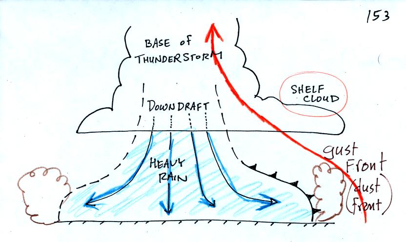
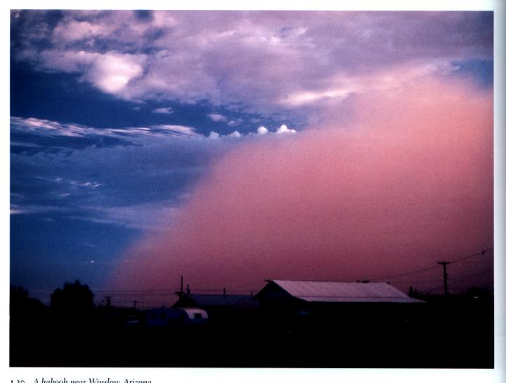
This is a
picture of a dust cloud stirred up by thunderstorm gust
front winds (taken near Winslow, Az). The gust front is moving
from the right to the
left. Visibility in the dust cloud can drop to near zero which
makes this a serious hazard to automobile traffic. Dust storms
like this are sometimes called haboobs.
The following picture shows a shelf cloud.
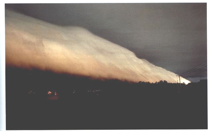
The gust front is
moving from left to right in this picture. The shelf cloud is
very close to the ground, so the warm air that was lifted by the gust
front must have been very moist. It didn't have to rise and cool
much before it became saturated and a cloud formed. This actually
appears to be the same picture as Fig. 11-15 in the textbook.
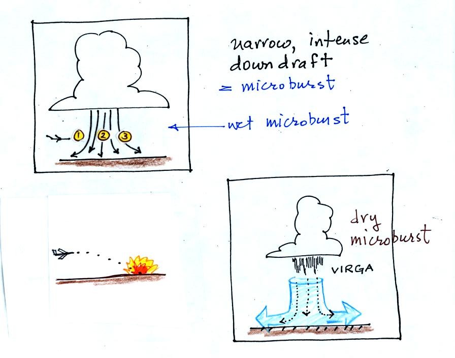
A narrow intense downdraft is
called a microburst. At
the ground
microburst winds will sometimes reach 100 MPH (over a limited area);
most tornadoes have winds of 100
MPH or less. Microburst winds can damage homes (especially mobile
homes that aren't tied to the ground), uproot trees, and
seem to blow over a line of electric power poles at some point every
summer in Tucson.
Microbursts are
a serious threat to aircraft especially when they are close to the
ground during landing or takeoff (see Fig. 11-20 in the text). An
inattentive pilot encountering headwinds at Point 1 could cut back on
the power. Very quickly the plane would lose the headwinds (Point
2) and then encounter tailwinds (Point 3). The plane might lose
altitude so quickly that it would crash into the ground before
corrective action could be taken.
Falling rain could warn of a (wet)
microburst.
In other cases, dangerous dry microburst winds might be invisible
(the virga, evaporating rain, will cool the air, make the air more
dense, and strengthen the downdraft winds).
A simple demonstration can give you an idea
of what a
microburst
might
look like.
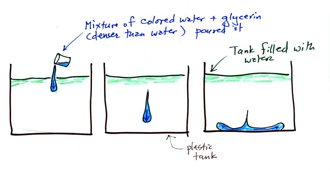
A large plastic tank
was filled with water, the
water
represents air in the atmosphere. Then a colored mixture of water
and glycerin, which is a little denser than water, is poured into the
tank. This
represents the cold dense air in a thunderstorm downdraft. The
colored liquid sinks to the bottom of the tank and then spreads out
horizontally. In the atmosphere the cold downdraft air hits the
ground and spreads out horizontally. These are the strong winds
that can reach 100 MPH.
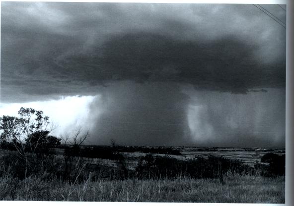
Here's a picture of a
wet microburst, a narrow intense
thunderstorm downdraft and rain.