Friday Nov. 6, 2009
click here to download today's notes in
a more printer friendly format.
Two or three songs (Limbs Akimbo, Beneath the Blossums, Two Loose
Cannons) from Hot Buttered Rum before class today. They'll be at
the Plush this coming Thursday.
What is the big event
this weekend? It's probably not what you were thinking.
Here's more
information and some photos.
In the next two or three classes we will be looking at how
and why
surface and upper level
winds blow the way they do.
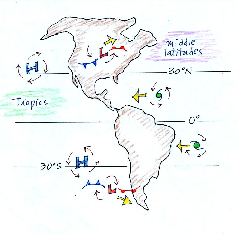
Some real world examples of where this occurs are shown in the figure
below. The two largest types of storm systems, middle latitude
storms and hurricanes, develop around surface centers of low
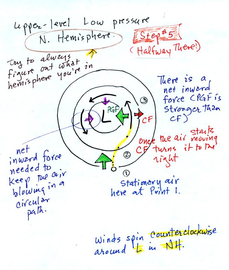
pressure. Winds
spin counterclockwise around low in the northern hemisphere and
clockwise in the southern hemisphere. Winds spin clockwise around
"anticyclones" (high pressure) in the northern hemisphere and
counterclockwise in the southern hemisphere.
Storm systems in the tropics (0 to 30 degrees latitude) generally move
from east to west. At
middle latitudes (30 to 60 degrees), storms move in the other
direction,
from west to
east. To understand why this is true we need to learn something
about the earth's global scale pressure and wind patterns. This
is a topic we will be getting into next week.
I've borrowed the carefully figures below from the Spring 2009
online notes. Much of this was on a 5 page handout distributed in
class.
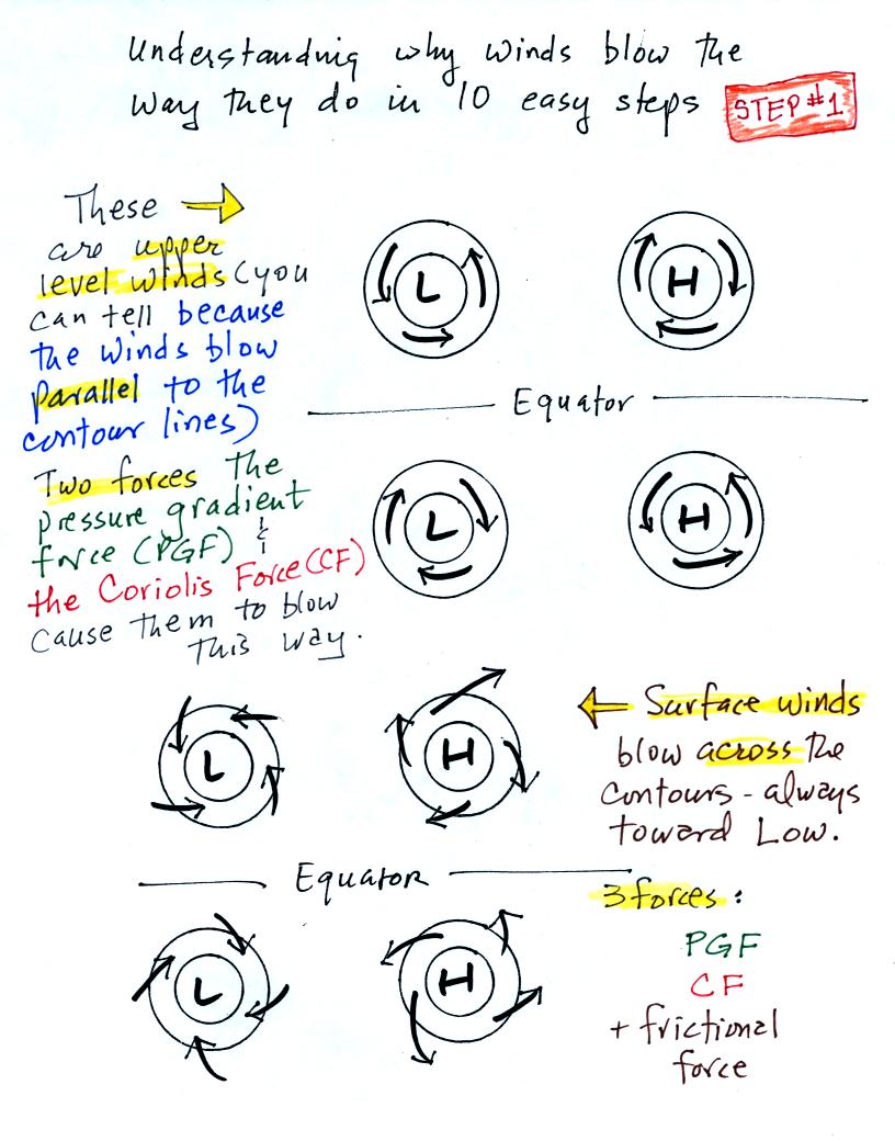
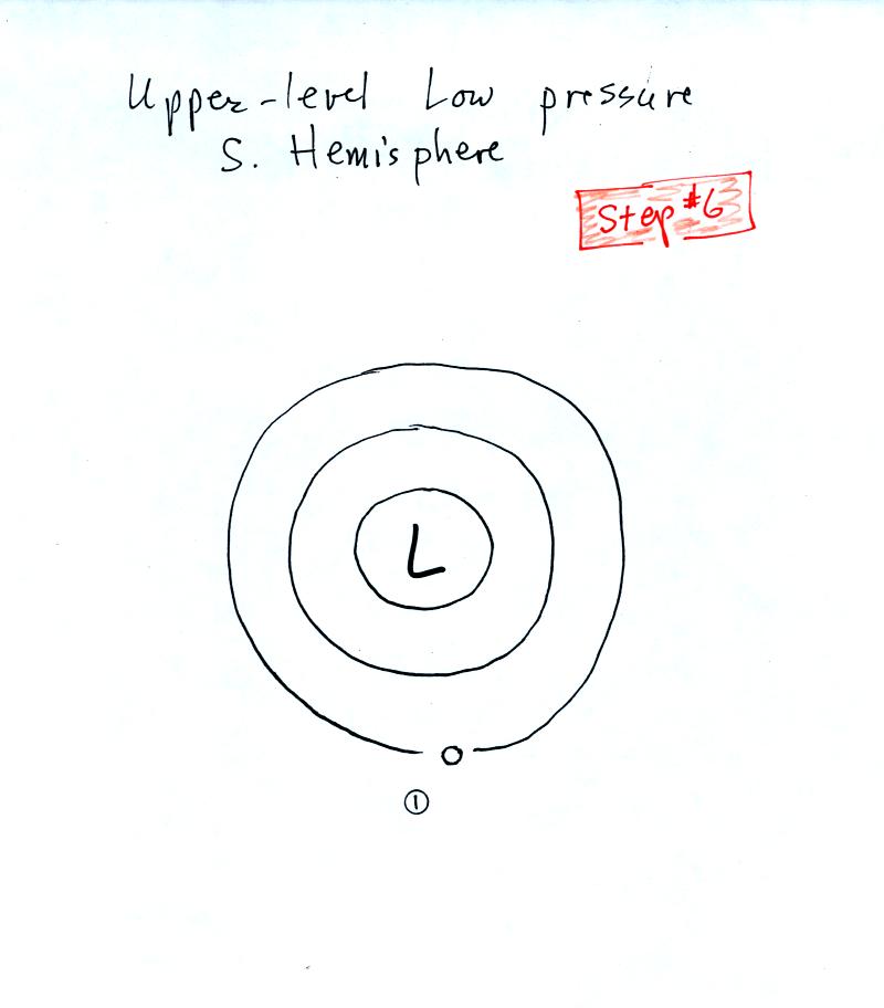
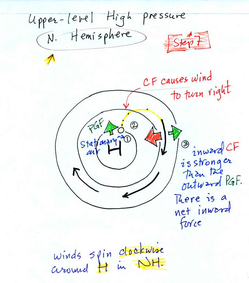
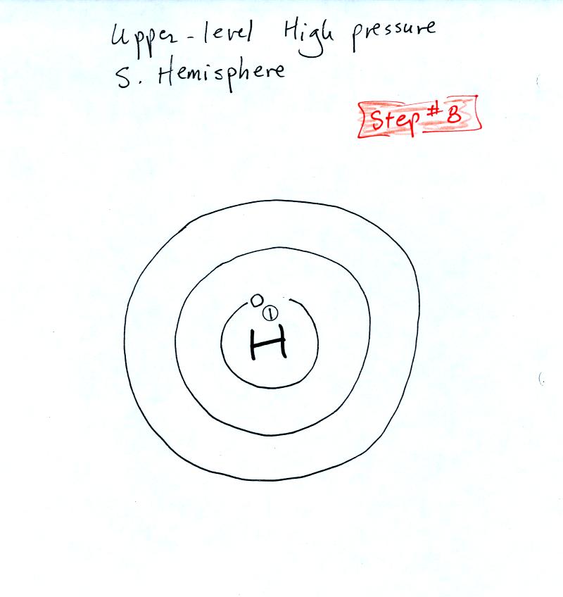
Upper level winds spinning around high and low pressure in the
northern and southern hemispheres are shown in the first set of four
pictures. The first thing to notice is that upper level winds
blow parallel to the contours. We will see that 2 forces, the
pressure gradient force (PGF) and the Coriolis force (CF), cause the
winds to blow this way. Eventually you will be able to
draw the directions of the forces for each of the four upper level
winds examples. Here is an
example
of what you will be able to do.
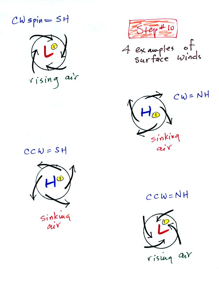
The four drawings at the bottom of the page show surface winds blowing
around high and low pressure in the southern hemisphere. These
winds blow across the contour lines slightly, always toward low
pressure. The frictional force is what causes this to
occur. He is
an example of what you will be able to say about surface winds
blowing around low pressure in the southern hemisphere.
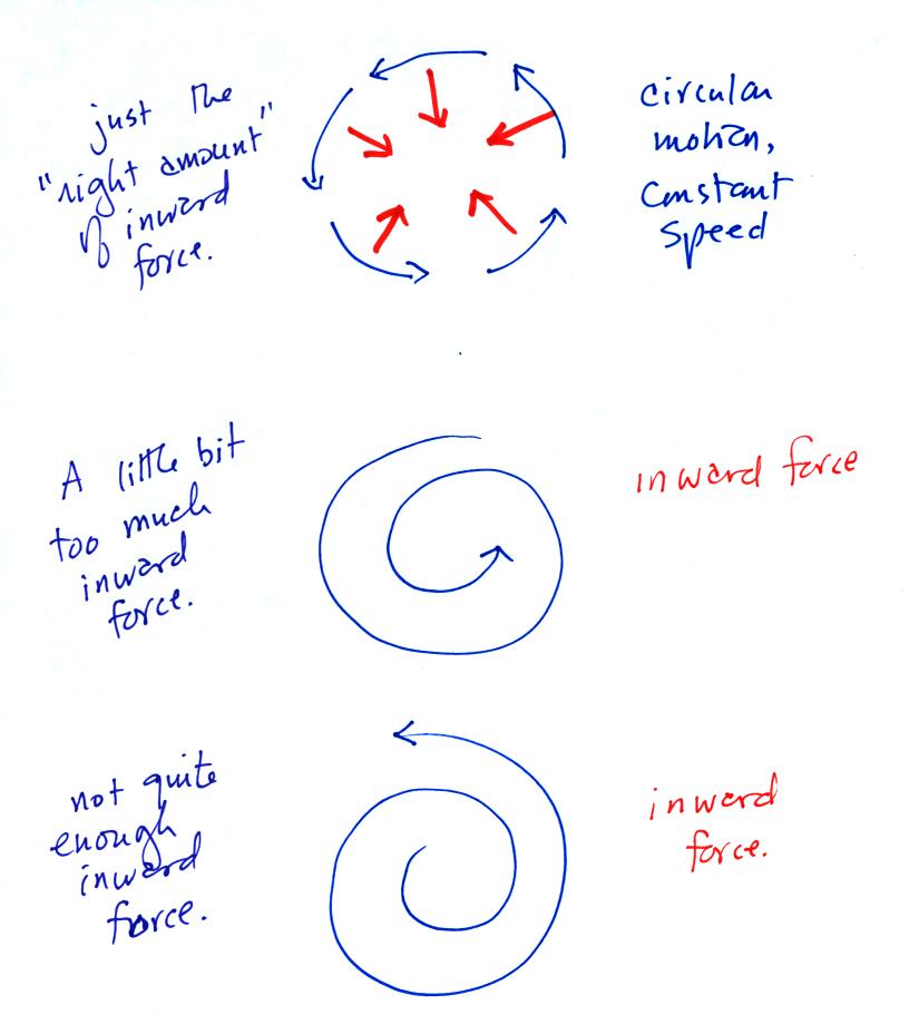
The force is inward in each of the cases below.
It's just not the same amount of inward force. The amount of
force is just right in the top figure, a little too strong in the
middle figure, and not quite strong enough in the bottom figure.
Now we'll
start to look at the forces that cause the wind.
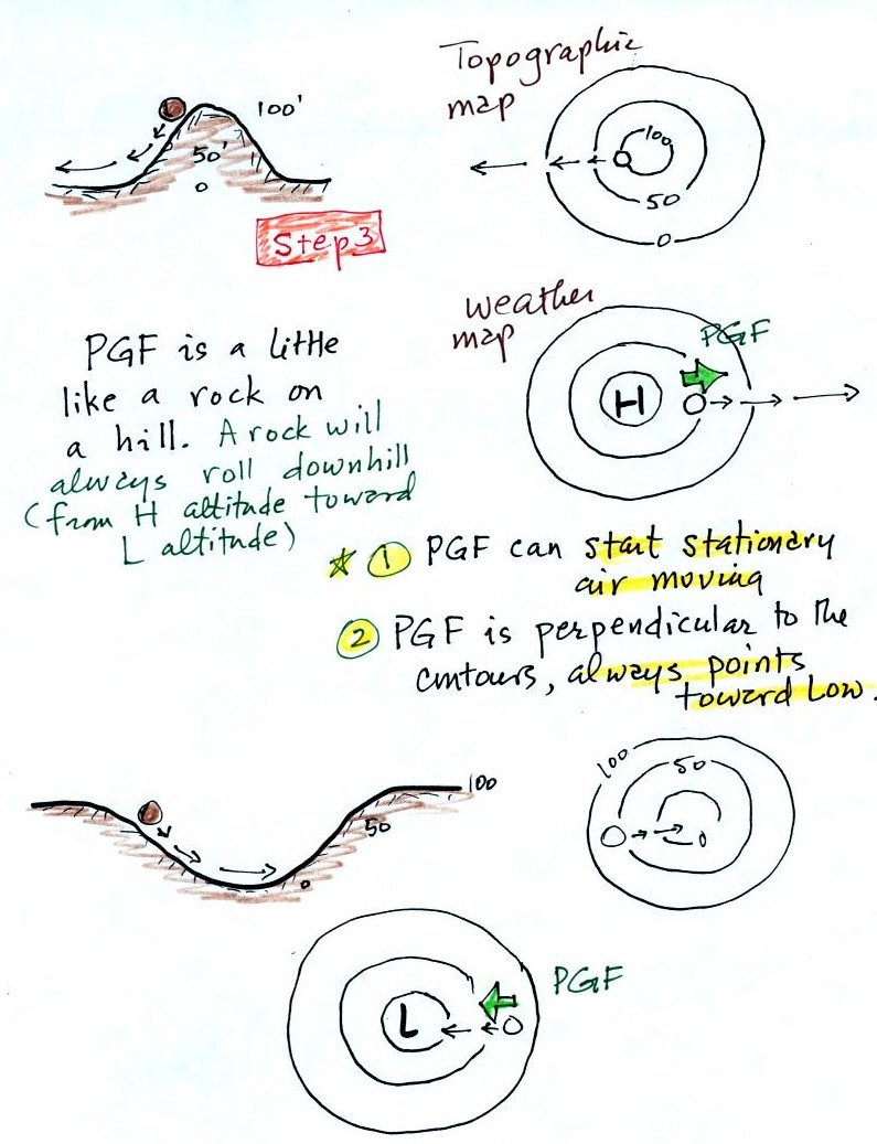
The pressure gradient force always points toward low pressure.
The PGF will cause stationary air to begin to move (it will always move
toward low
pressure).
The Coriolis force is caused by the rotation of the earth and points
perpendicular to the wind. It can only
change the wind's direction, it can't cause the wind to speed up or
slow down. The direction of the CF depends on whether you're in
the northern or southern hemisphere. The next section explains
the origin of the Coriolis force, we
didn't cover this section in class on Friday.
Most of
what follows can
be found on p. 122c in the photocopied ClassNotes.
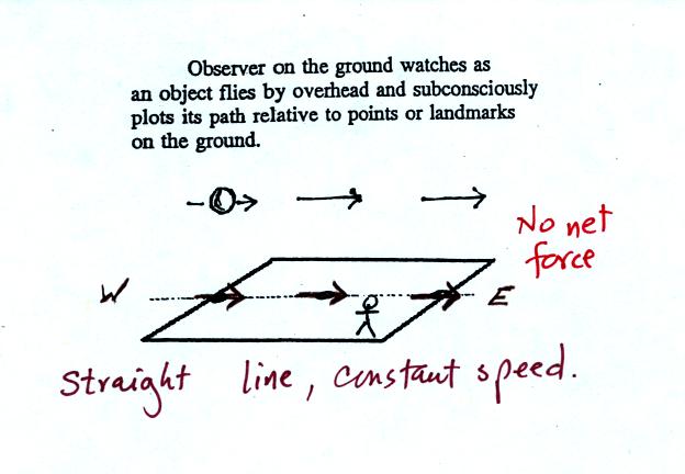
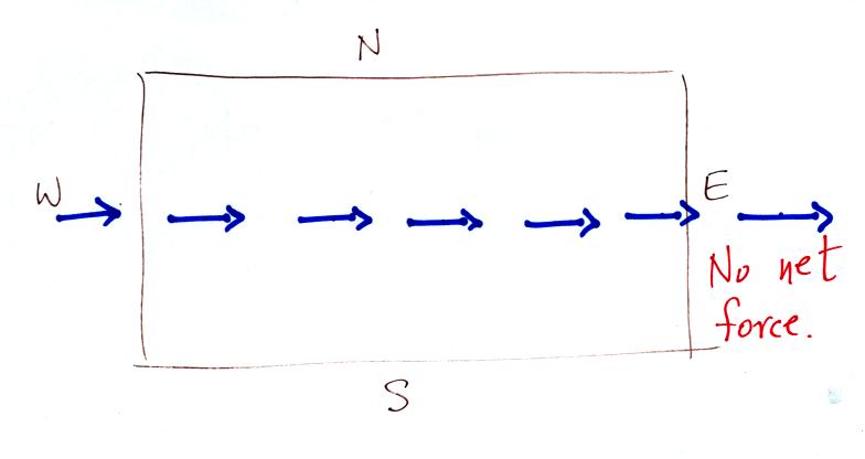
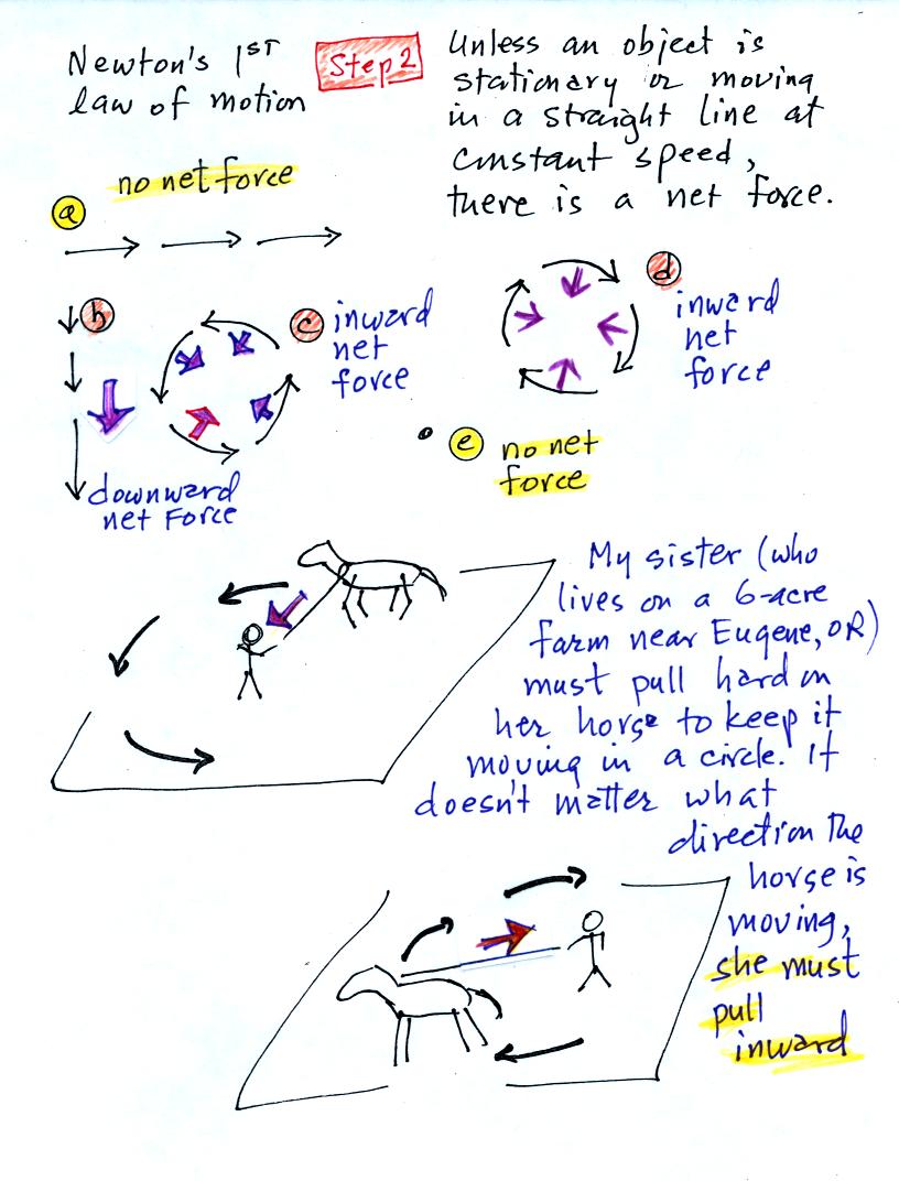
Imagine something flies over Tucson. It
travels
straight from west to east at constant speed. The next figure
shows the path that
the object followed as it passed over the city. You would, more
or less subconciously, plot its path relative to reference points
on
the ground.
It would appear to be moving in a straight line at constant
speed. You would conclude there was zero net force acting on the
moving object (Newton's first law of motion).
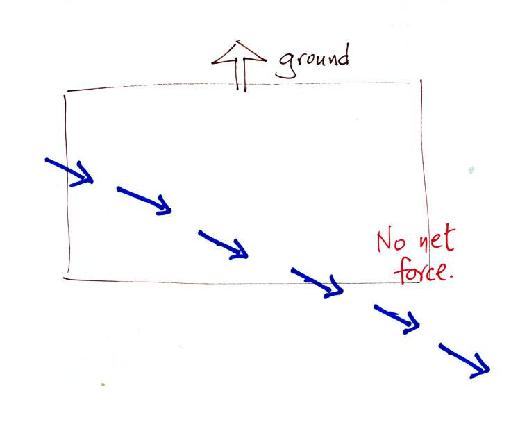
In this second picture the object flies by overhead
just as it
did in the previous picture. In this picture, however, the ground
is moving (don't worry about what might be causing the ground to move).
This is the path that you would see relative to the ground
in this
case. Even though the object flew from west to east it
appears to have been traveling from the NW toward the SE because the
ground was moving as the object passed overhead. Because
the motion is still in a straight line at constant speed, you would
conclude the net force acting on the object was zero.
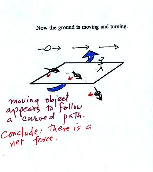
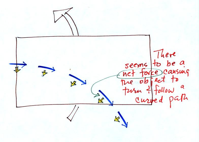
In this last figure the object flies by again from
west to
east. In this case however the ground is rotating.
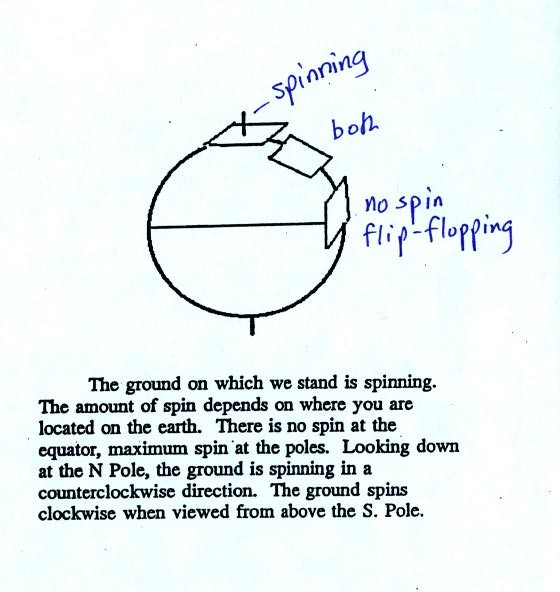
At most locations on the earth the ground IS rotating (we're just not
aware of it). This is
most easily seen at the poles.
Imagine a piece of paper glued to the top of a globe.
As the
globe spins the piece of paper will rotate. A piece of paper
glued to the globe at the equator won't spin, it will flip over.
At points in between the paper would spin and flip, the motion gets
complicated.
The easiest thing for us to do is to ignore the fact that the ground on
which we are standing is rotating. However, if we do that we need
to account for the curved paths that moving objects will take when they
move relative to the earth's surface. That is what the Coriolis
force does.
See if you can figure out what to do with this figure. When you
think you have the answer click here.
With high pressure the air starts moving outward. In this
example
the wind takes a right turn and ends up blowing in a clockwise
direction around the high. Note there is a net inward force here
just as there was with the two previous examples involving low pressure.
Try this one on your own. When you think you have the
answer, click here.
We didn't cover the next two or three
figures in class on Friday. We'll cover this on Monday.
The next two figures cover surface winds
The top figure shows upper level winds blowing parallel to
straight contours. The PGF and CF point in opposite directions
and have the same strength. The net force is zero. The
winds would blow in a straight line at constant speed.
We add friction in the second picture. It points in a direction
opposite the wind and can only slow the wind down. The strength
of the frictional force depends on wind speed (no frictional force if
the wind is calm) and the surface the wind is blowing over (less
friction over the ocean than over the land).
Slowing the wind weakens the CF and it can no longer balance the
PGF. The stronger PGF causes the wind to turn and blow across the
contours toward Low.
Eventually the CF and Frictional force, working together, can balance
out the PGF.

The winds are spiralling inward in the top and bottom
examples.
These must be surface centers of low pressure. The middle two
examples are high pressure. The winds spin in the same directions
around surface highs and lows as they do around upper levell highs and
lows.
Converging winds cause air to
rise. Rising air expands and cools and can cause clouds to form
(I'll bet you're getting sick of hearing that). Diverging winds
created sinking wind motions and result in clear skies.