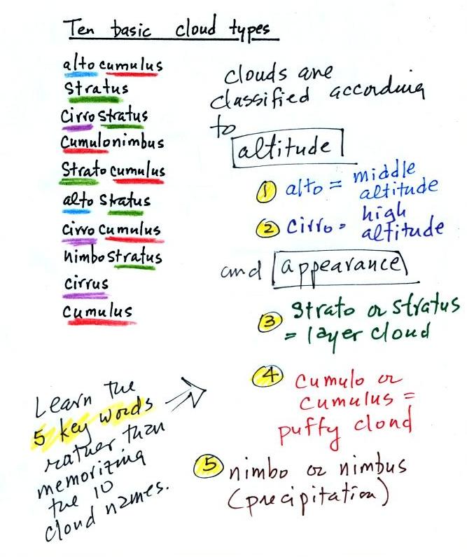
I'm hoping you'll try to learn these 10 cloud
names. There is a smart and a not-so-smart way of
learning
these names. The not-so-smart way is to just memorize them.
Because they all sound alike you
will inevitably get them mixed up. A better way is to recognize
that all
the cloud names are made up of key words. The 5 key words tell
you something about the cloud's altitude and appearance.
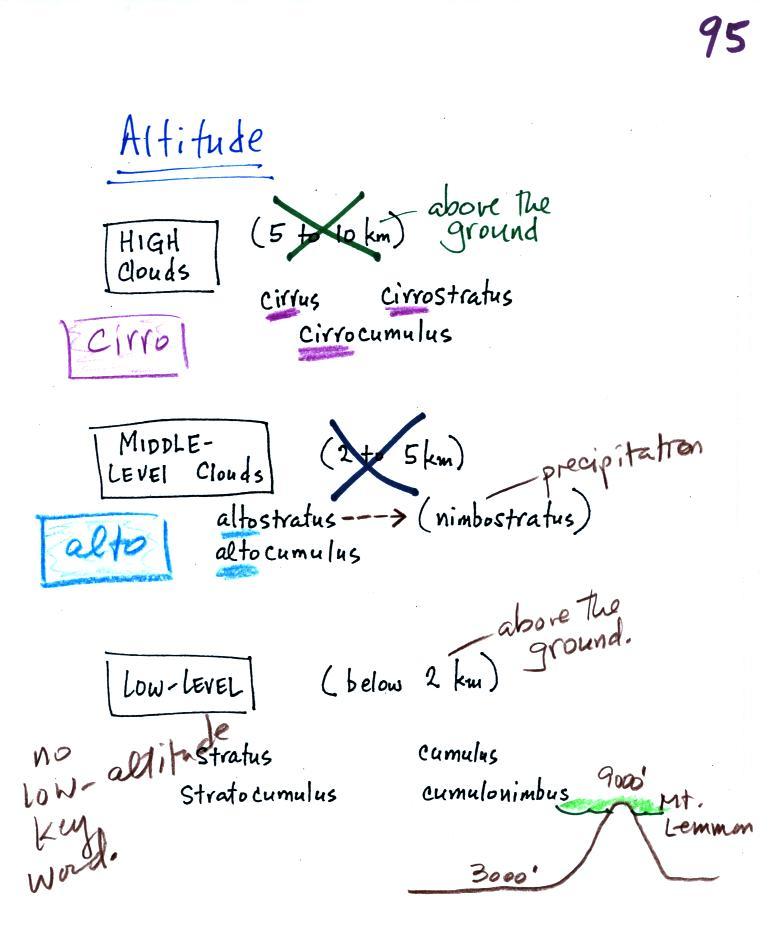
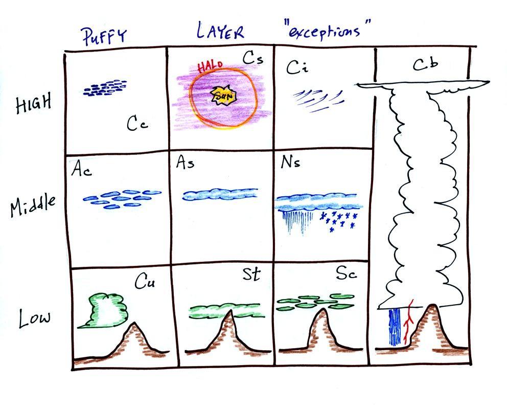
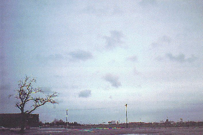
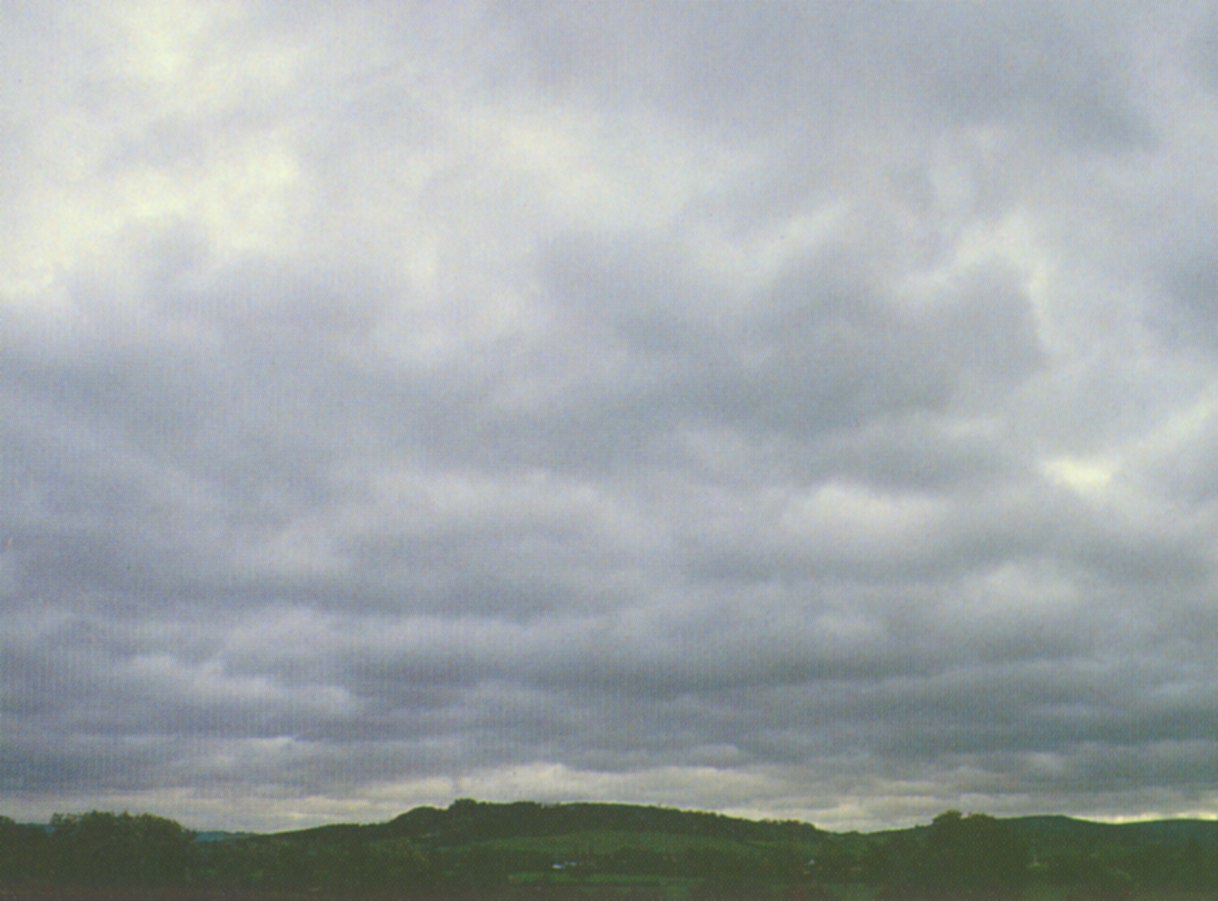
Clouds are grouped into one of three altitude categories: high, middle level, and low. It is very hard to just look up in the sky and determine a cloud's altitude. You will need to look for other clues to distinquish between high and middle altitude clouds. We'll learn about some of the clues when we look at cloud pictures later in the class.
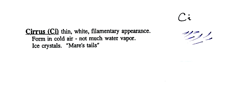
Cirrus or cirro
identifies a high altitude
cloud. There are three types of clouds found in the high altitude
category..
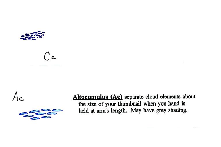
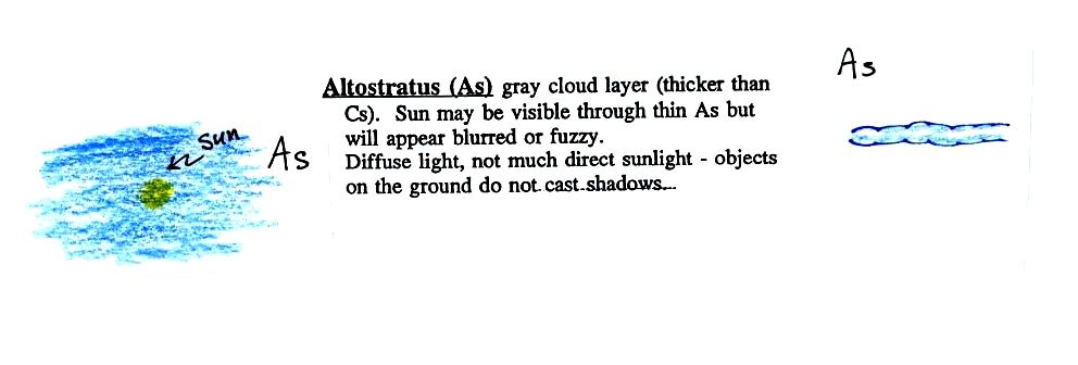
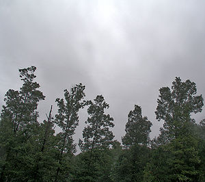
Alto in a cloud name means the cloud is found at middle altitude.
The
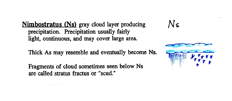
arrow connecting altostratus and nimbostratus indicates that they are
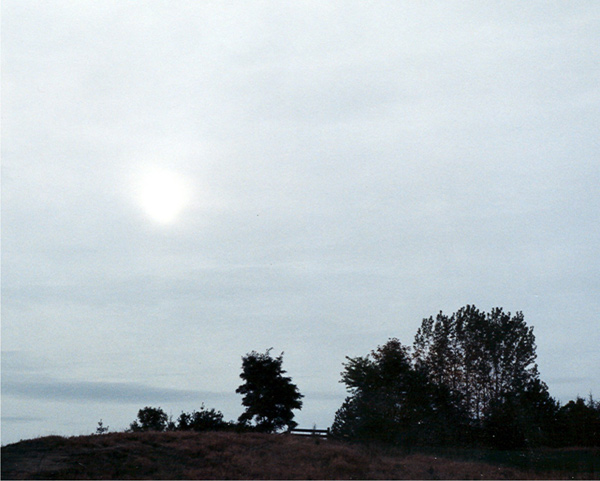
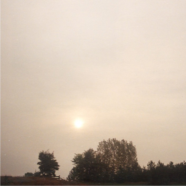
basically the same kind of cloud. When an altostratus cloud
begins to produce rain or snow
its
name is changed to nimbostratus. A nimbostratus cloud is also
often somewhat
thicker and lower than an altostratus cloud. Sometimes it might
sneak into the low altitude category.
There is no key word for low altitude clouds. Low altitude clouds
have
bases that form 2 km or less above the ground. The summit of
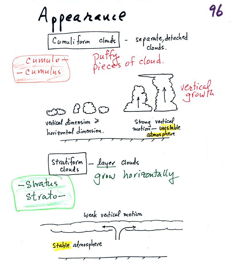
Clouds can have a patchy of puffy (or lumpy,
wavy, or ripply) appearance.
These
are cumuliform clouds and will have cumulo
or cumulus
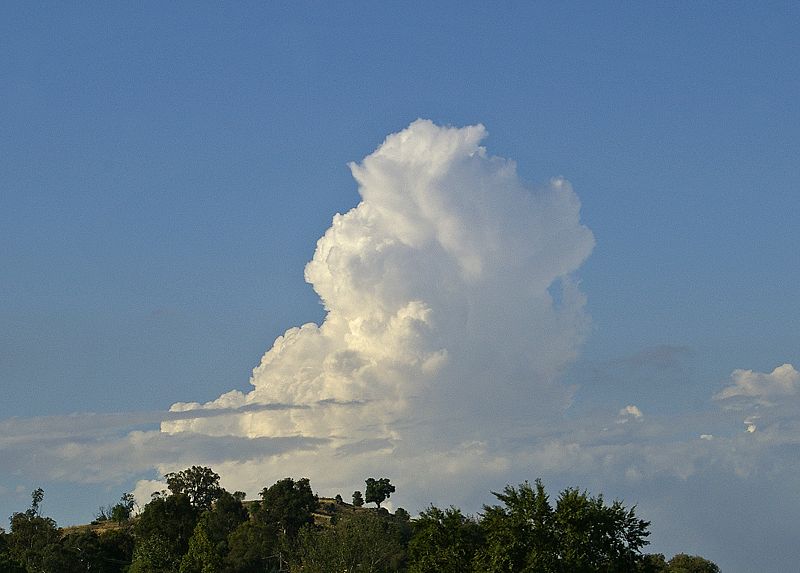
in their name. In an unstable atmosphere cumuliform clouds will
grow vertically.
Strong thunderstorms can produce dangerous severe weather.
Stratiform clouds grow horizontally and
form
layers. They form when the atmosphere is stable.

The last key word, nimbo
or nimbus, means
precipitation (it is also the name of a local brewing company). Only
two of the 10 cloud types are able to produce
(significant
amounts of) precipitation. It's not as easy as you might think to
make precipitation. We'll start to look at precipitation
producing processes in class on Wednesday.

Here's the cloud chart from earlier. We've added the three altitude categories along the vertical side of the figure and the two appearance categories along the top. By the end of the class we will add a picture to each of the boxes.
High altitude
clouds
are thin
because the air at high altitudes is very cold and cold air can't
contain much
moisture (the saturation mixing ratio for cold air is very
small). These
clouds are also often blown around by fast high altitude winds.
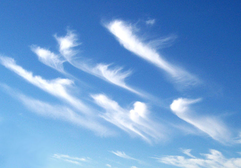
Filamentary means "stringy" or "streaky". If you
imagine trying to paint a Ci cloud you
would dip a
small pointed brush in white paint brush it quickly and lightly across
a blue
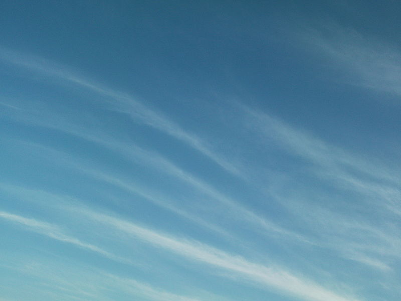
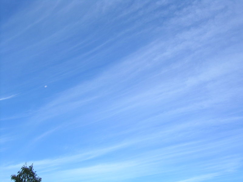
colored canvas. Here are some pretty good photographs of cirrus
clouds (they are all from a Wikipedia article on
Cirrus Clouds)
 |
 |
 |
 |

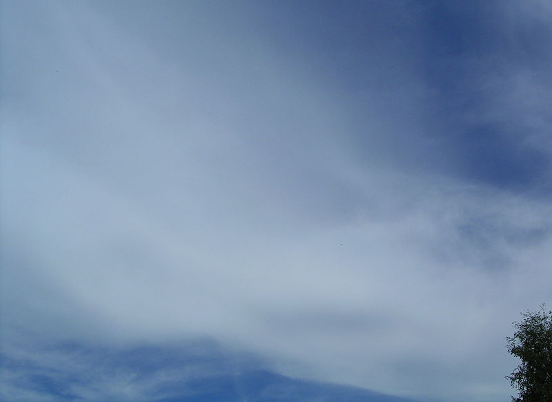
A
cirrostratus cloud is a thin uniform white layer cloud (not purple as
shown in
the figure) covering part or all of the sky. They're so thin you
can
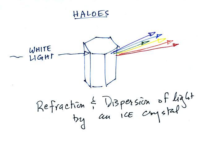
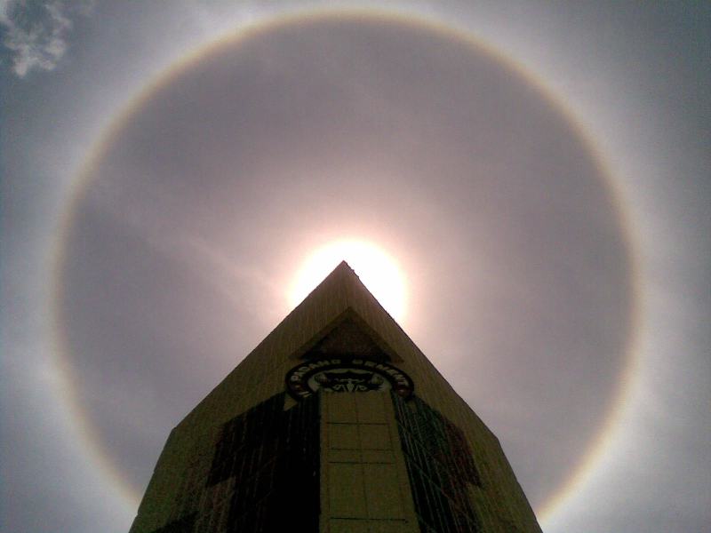
sometimes see blue sky through the cloud layer. Haloes are a
pretty sure
indication that a cirrostratus cloud is overhead. If you were
painting Cs
clouds you could dip a broad brush in watered down white paint and then
paint back and forth across the canvas.
If you spend
enough time outdoors looking up at the sky you will
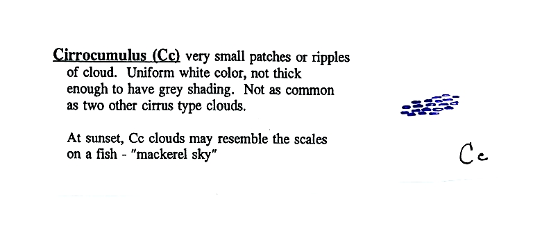
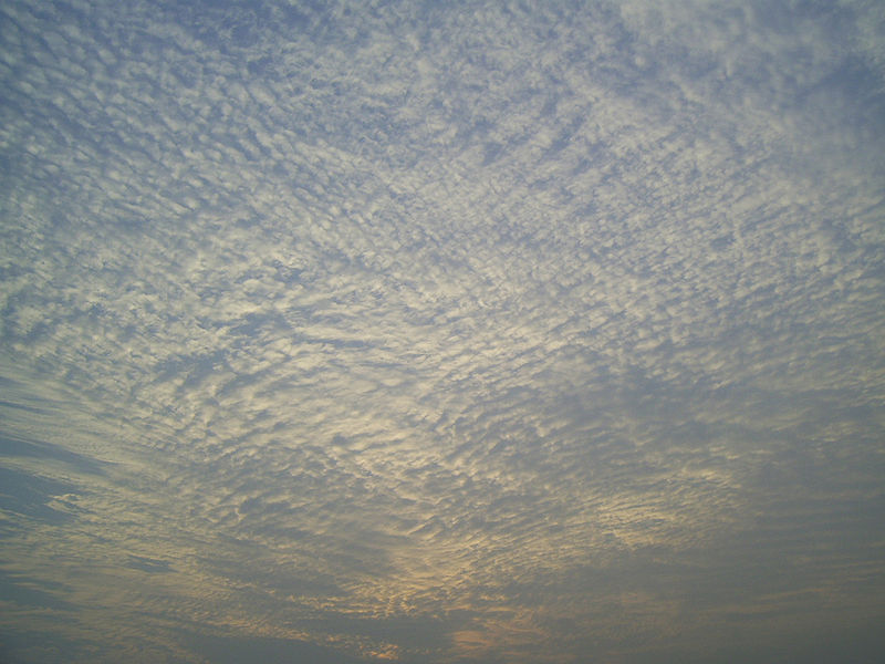
eventually see all 10 cloud types. Cirrus and cirrostratus clouds
are fairly common. Cirrocumulus
clouds are
a little more unusual. The same is true with animals,
some
are more commonly
seen than others.
 |
 |
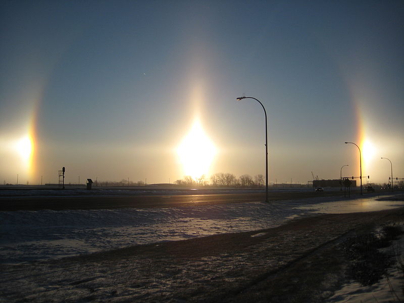
Now a detour to
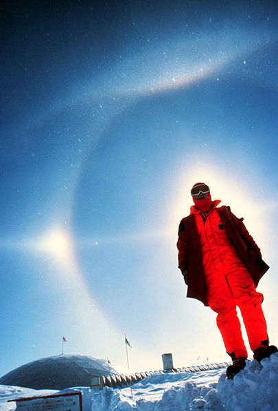
briefly discuss haloes and sundogs.


 |
 |
 |
 |
 |
 |
 |
 |
 |
 |
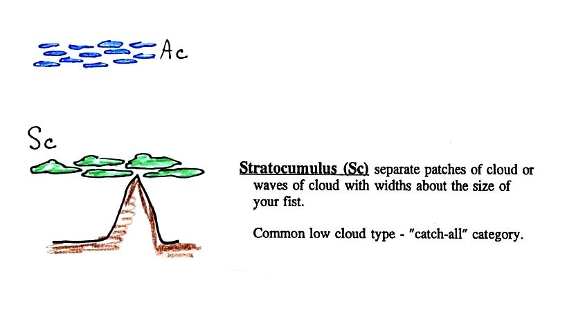
This cloud name
is a
little
unusual because the two key words for cloud appearance have been
combined, but that's a good description of this cloud type - a "lumpy
layer cloud".
 |
 |
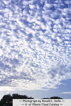
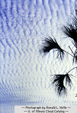
Because they are closer to the ground, the
separate
patches of
Sc are about fist size. The patches of Ac, remember, were about
thumb
nail size.(sources of the photographs:
left photo, right
photo ). If the cloud fragments in the photo at right are
clearly separate from each other (and you would need to be underneath
the clouds so that you could look up) these clouds would probably be
"fair weather" cumulus. If the patches of cloud are touching then
stratocumlus would be the correct designation.


 |
 |

There are lots of
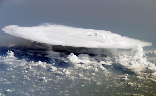
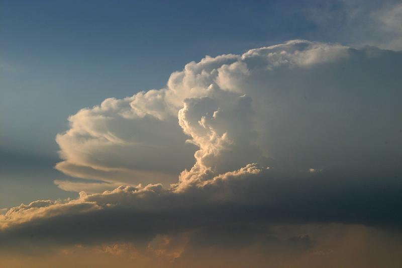
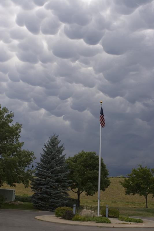
distinctive
features on cumulonimbus clouds including the flat anvil top and the
lumpy mammatus clouds sometimes found on
the underside of the
anvil.
Cold dense
downdraft winds hit the ground below a
thunderstorm and
spread out horizontally underneath the cloud. The leading edge of
these
winds produces a gust front (dust front might be a little more
descriptive).
Winds at the ground below a thunderstorm can exceed 100 MPH, stronger
than many
tornadoes.
The top of a thunderstorm (violet in the sketch) is cold enough that it will be composed of just ice crystals. The bottom (green) is composed of water droplets. In the middle of the cloud (blue) both water droplets and ice crystals exist together at temperatures below freezing (the water droplets have a hard time freezing). Water and ice can also be found together in nimbostratus clouds. We will see that this mixed phase region of the cloud is important for precipitation formation. It is also where the electricity that produces lightning is generated.
 |
 |
 |
 |
The top left
photo shows a thunderstorm viewed from space (source: NASA Earth Observatory).
The
flat anvil top is the dominant feature. The remaining three
photographs are from the UCAR
Digital
Image Library. The bottom left photograph shows heavy
by localized rain falling from a thunderstorm. At bottom right is
a photograph of mammatus clouds found on the underside of the flat
anvil cloud.

Cold air spilling
out
of the base
of a thunderstorm is just beginning to move outward from the bottom
center of the
storm in the picture at left. In the picture at right the
cold air
has moved further outward and has begun to get in the way of the
updraft.
The updraft is forced to rise earlier and a little ways away from the
center of
the thunderstorm. Note how this rising air has formed an extra
lip of
cloud. This is called a shelf cloud.
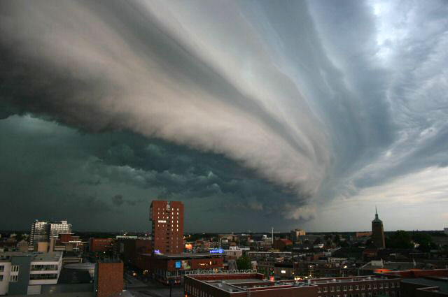
Shelf clouds can sometimes be quite
impressive (the picture above is from a Wikipedia article on
arcus clouds)