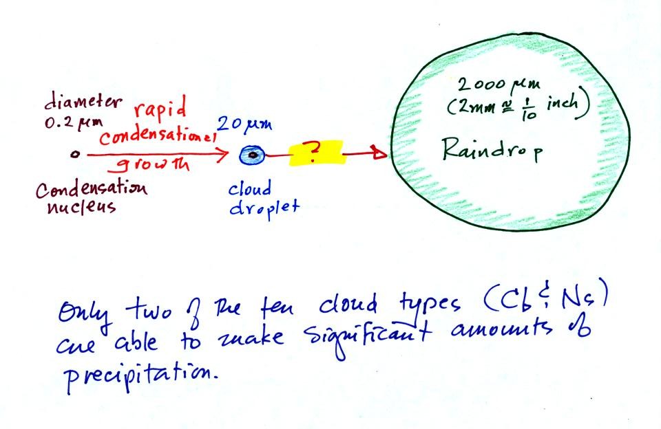
This figure shows typical sizes of cloud condensation nuclei (CCN), cloud droplets, and raindrops (a human hair is about 50 μm thick for comparison). As we saw in the cloud in a bottle demonstration it is relatively easy to make cloud droplets. You cool moist air to the dew point and raise the RH to 100%. Water vapor condenses pretty much instantaneously onto a cloud condensation nucleus to form a cloud droplet. It would take much longer (a day or more) for condensation to turn a cloud droplet into a raindrop. You must know from personal experience that once a cloud forms you don't have to wait that long for precipitation to begin to fall.
 |
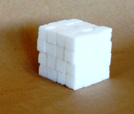 |
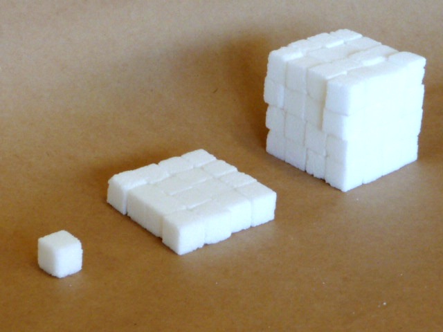
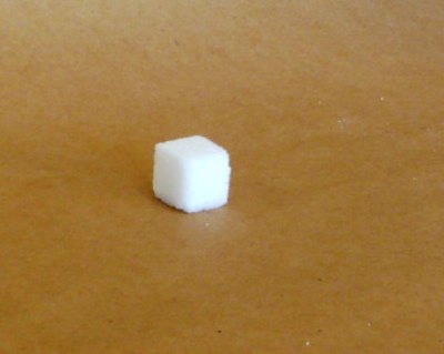
It would take 16 sugar cubes to make each layer and there are 4 layers. So you'd need 64 sugar cubes. Volume is length x width x height.
Fortunately there are two processes capable of quickly turning small cloud droplets into much larger precipitation particles in a cloud.
The collision coalescence process works in clouds that are composed of water droplets only. Clouds like this are only found in the tropics. We'll see that this is a pretty easy process to understand.
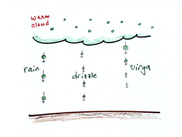
This process will only produce rain, drizzle, and something called virga (rain that evaporates before reaching the ground). Because the clouds are warm and warm air can potentially contain more water vapor than cooler air, the collision-coalescence process can produce very large amounts of rain.
The ice crystal process produces precipitation everywhere else. This is the process that makes rain in Tucson, even on the hottest day in the summer (summer thunderstorm clouds are tall and reach into cold parts of the atmosphere, well below freezing). Hail and graupel often fall from these storms; proof that the precipitation started out as an ice particle). Thunderstorms also produce lightning and later in the semester we will find that ice is needed to make the electrical charge that leads to lightning.
There is one part of this process that is a little harder to understand, but look at the variety of different kinds of precipitation particles (rain, snow, hail, sleet, graupel, etc) that can result.
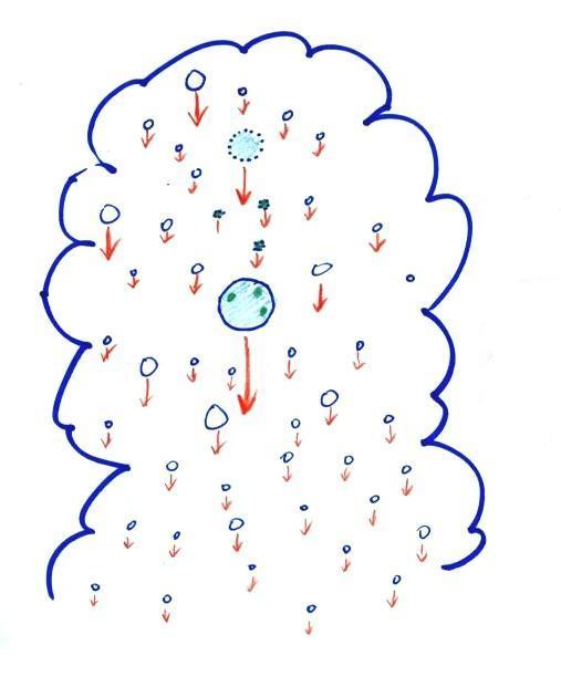
Here's how the collision coalescence process works. The picture below shows what you might see if you looked inside a warm cloud with just water droplets:
 |
 |

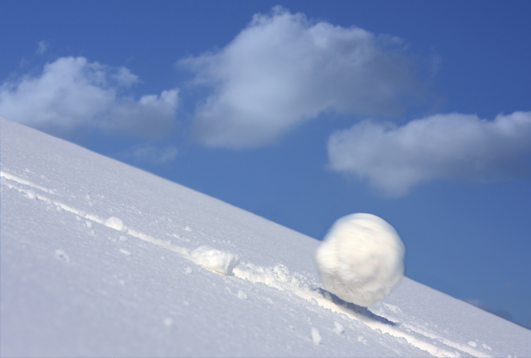
A larger than average cloud droplet can very quickly grow to raindrop size.
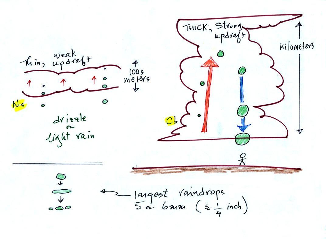
The figure shows the two precipitation producing clouds: nimbostratus (Ns) and cumulonimbus (Cb). Ns clouds are thinner and have weaker updrafts than Cb clouds. The largest raindrops fall from Cb clouds because the droplets spend more time in the cloud growing. In a Cb cloud raindrops can grow while being carried upward by the updraft and also when falling in the downdraft.
Raindrops grow up to about 1/4 inch in diameter. When drops get larger than that, wind resistance flattens out the drop as it falls toward the ground. The drop begins to "flop" or "wobble" around and breaks apart into several smaller droplets. Solid precipitation particles such as hail can get much larger (an inch or two or three in diameter).
And actually my sketch at lower left above isn't quite accurate as this video of the breakup of a 5 mm diameter drop of water shows.
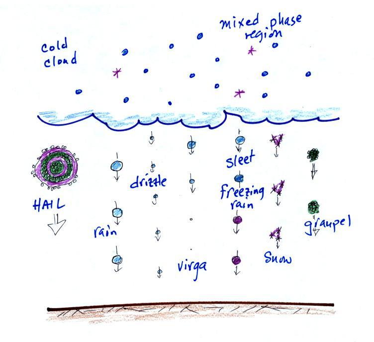
The figure below shows the internal structure of cold clouds.
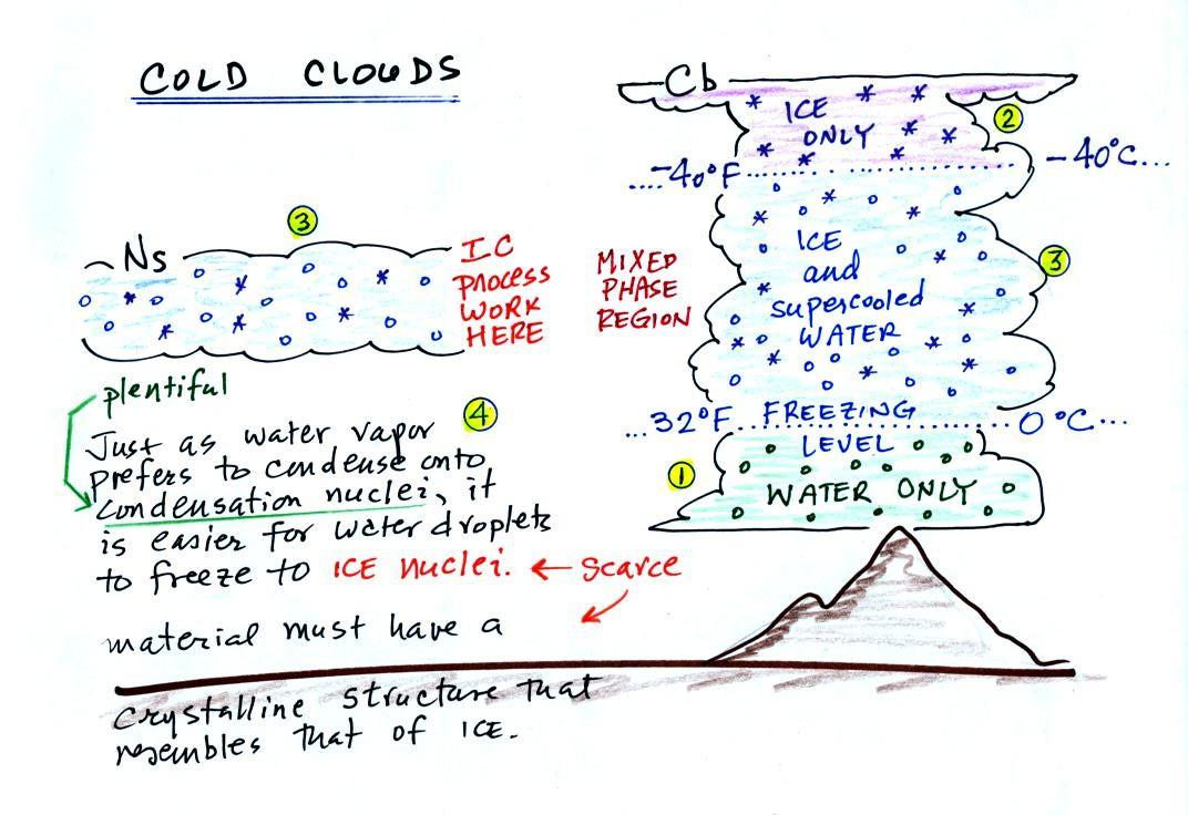
The bottom of the thunderstorm, Point 1, is warm enough (warmer than freezing) to just contain water droplets. The top of the thunderstorm, Point 2, is colder than -40 F (which, coincidentally, is equal to -40 C) and just contains ice crystals. The interesting part of the thunderstorm and the nimbostratus cloud is the middle part, Point 3, that contains both supercooled water droplets (water that has been cooled to below freezing but hasn't frozen) and ice crystals. This is called the mixed phase region. This is where the ice crystal process will be able to produce precipitation. This is also where the electrical charge that results in lightning is created.
The supercooled water droplets aren't able to freeze even though they have been cooled below freezing. At Point 4 we see this is because it is much easier for small droplets of water to freeze onto an ice crystal nucleus (just like it is easier for water vapor to condense onto condensation nuclei rather than condensing and forming a small droplet of pure water). Not just any material will work as an ice nucleus however. The material must have a crystalline structure that is like that of ice. There just aren't very many materials with this property and as a result ice crystal nuclei are rather scarce. In most of the mixed phase region there are more water droplets than ice crystals.
Supercooled water
Here are a couple of demonstrations involving supercooled water that I showed in class. In the first demonstration, some supercooled water (cooled to -6 F (-21 C)) is poured into a glass bowl sitting at room temperature. Just pouring the water into the bowl is enough of a "disturbance" to cause the supercooled water to freeze. Just bumping a bottle of supercooled water in the second video is enough to cause the water to freeze. I don't know why that happens.
Superheated water
It is also possible to superheat water. When the superheated water is disturbed it suddenly and explosively boils. This is potentially dangerous demonstration to attempt, better to watch a video online.
Here are a some precautions just in case you're ever tempted to try an experiment like this.
It is probably easier to superheat distilled water than ordinary tap water. So you might put two cups of water into a microwave, one with tap water the other filled with distilled water. The cup of tap water will probably start boiling when it is supposed to, i.e. before it can become superheated. You can watch the tap water and get an idea of how long you need to heat the distilled water to superheat it. I suspect impurities in the tap water might act as nuclei to initiate the boiling.
Then once you think you have superheated the cup of distilled water be very careful taking it out of the microwave (better yet leave it in the microwave). Just the slightest disturbance might start the water boiling. You want your hands, arm, body and faced covered and protected just in case this happens. Tape a spoon onto the end of a long stick and put a little sugar or salt into the spoon. Then drop the salt or sugar into the cup of superheated water.
Here's a far safer experiment that you can try, one that I didn't mention in class
Bubbles in beer or soda
Carbonated drinks all contain dissolved carbon dioxide. The drink containers are pressurized. When you open the can or take the cap off the pressure inside is released and dissolved carbon dioxide gas starts to come out of solution and forms small bubbles. Often you will see the bubbles originate at a point on the side or bottom of the glass. These are nucleation sites and are often small scratches or defects on the surface of the glass that are filled with a small bubble of air. When the carbon dioxide comes out of solution rather than forming a bubble of its own, it takes advantage of these existing bubbles of air. The bubble, now a mixture of air and carbon dioxide, grows until it is able to break free and float to the surface (a little gas is left behind so the process can start over again).
The next time you are drinking one of these carbonated beverages sprinkle in a few grains of sugar or salt. These will serve as additional nucleation site and additional bubbles will form.


To be in equilibrium the ice crystal only needs 1 arrow of condensation. There doesn't need to be as much water vapor in the air surrounding the ice crystal to supply this lower rate of condensation.
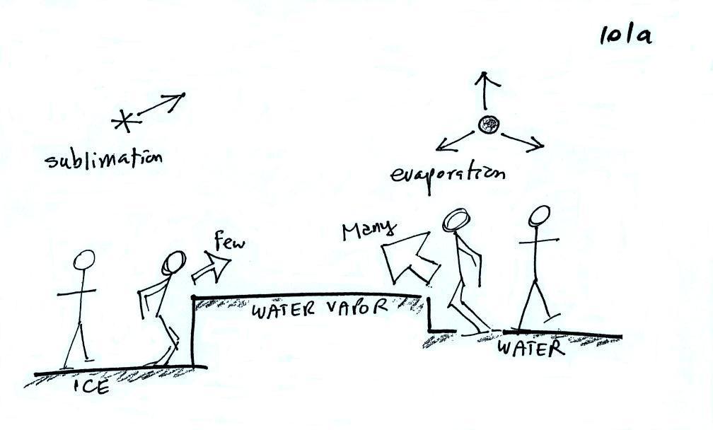
Now what happens in the mixed phase region of a cold cloud is that ice crystals find themselves in the very moist surroundings needed for water droplet equilibrium. This is shown below.
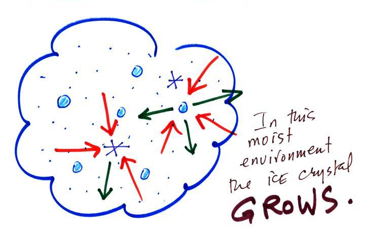
The equal rates of condensation are shown in the figure below using the earlier analogy.

Most everyone can manage to make the big or the small jump down.
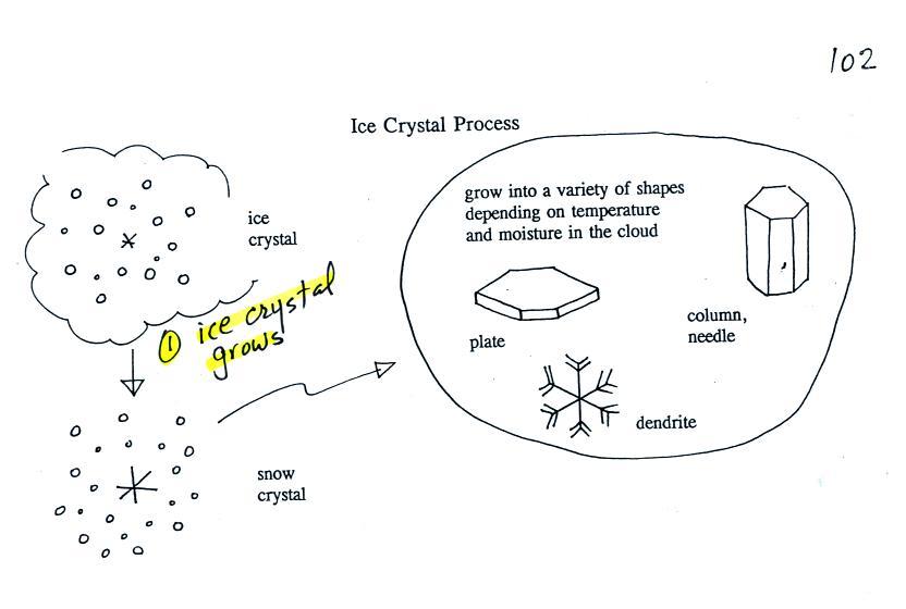
Once an ice crystal has grown a little
bit it becomes a snow crystal (this figure is on p. 102 in
the photocopied classnotes). Snow crystals can have a
variety of shapes (plates, dendrites, columns, needles,
etc.; these are called crystal habits) depending on the
conditions (temperature and moisture) in the cloud.
Dendrites are the most common because they form where there
is the most moisture available for growth. With more
raw material available it makes sense there would be more of
this particular snow crystal shape.

You'll find some much better photographs and a pile of additional information about snow crystals at www.snowcrystals.com.
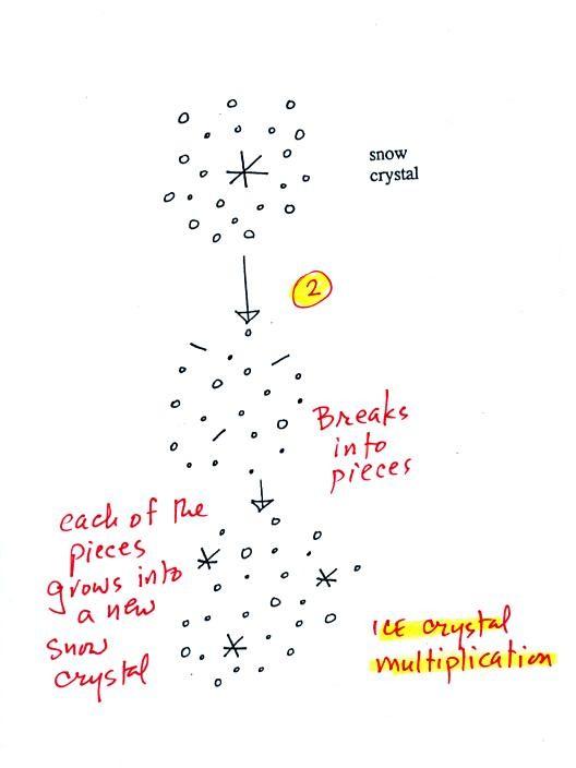
A variety of things can
happen once a snow crystal forms. First it can break
into pieces, then each of the pieces can grow into a new
snow crystal. Because snow crystals are otherwise in
rather short supply, ice crystal multiplication is a way of
increasing the amount of precipitation that ultimately falls
from the cloud.
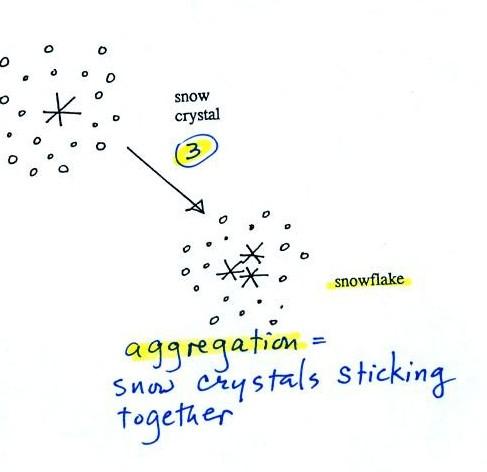
Several snow crystals can collide and stick together to form a snowflake. Snow crystals are small, a few tenths of a millimeter across. Snowflakes can be much larger and are made up of many snow crystals stuck together. The sticking together or clumping together of snow crystals is called aggregation (I frequently forget the name of this process and don't expect you to remember it either).
The next process and particle are
something that I hope you will remember.
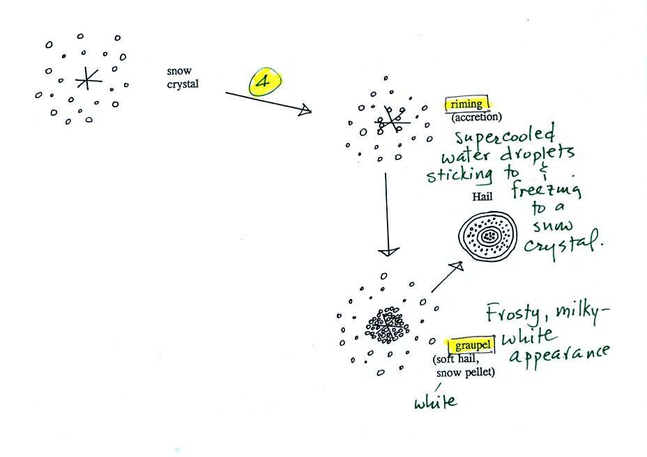
Snow crystals can collide with
supercooled water droplets. The water droplets may
stick and freeze to the snow crystal. This process is
called riming or accretion (note this isn't called collision
coalescence even though it is the same idea). If a
snow crystal collides with enough water droplets it can be
completely covered with ice. The resulting particle is
called graupel. Graupel is sometimes mistaken for hail
and is called soft hail or snow pellets. Rime ice has
a frosty milky white appearance. A graupel particle
resembles a miniature snow ball. Or smaller finer
grained version of the shaved ice in a "snow cone."
Graupel particles often serve as the nucleus for a
hailstone.
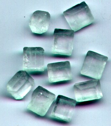
Graupel is made of milky white frosty
rime ice. Sleet, we will find, is made of clear
ice. Here are some pictures to help you better
appreciate the differences in appearance. These pictures weren't shown in class.
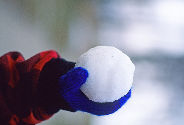 Here's a snowball. It's
white and you can't see through it. It's made up
of lots of smaller crystals of ice. Graupel is
just a small snowball.
source
|
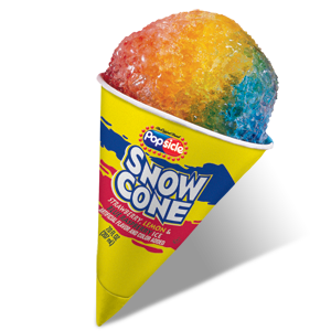 The ice in a snow cone is
basically the same. Lots of smaller chunks of
ice. The ice is frosty white (before you added
the flavored syrup. )
source
|
Graupel is sometimes referred as snow pellets. Sleet is sometimes called ice pellets.
 source of this photograph |
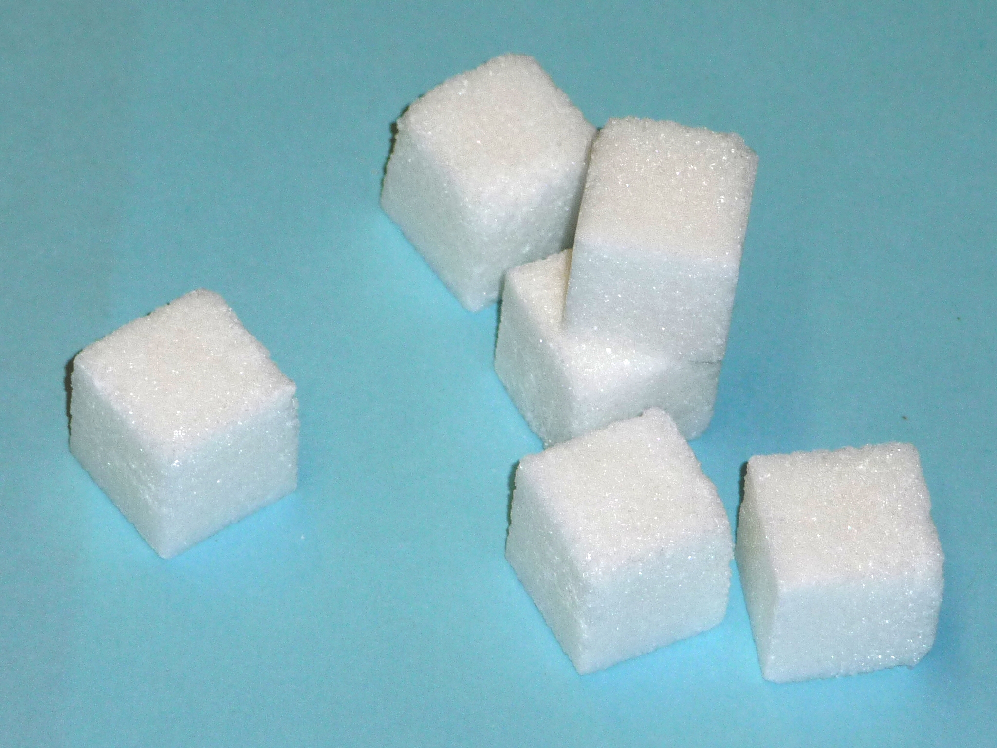 sugar cubes are made up of many much smaller grains of sugar and have a frosty white appearance. |
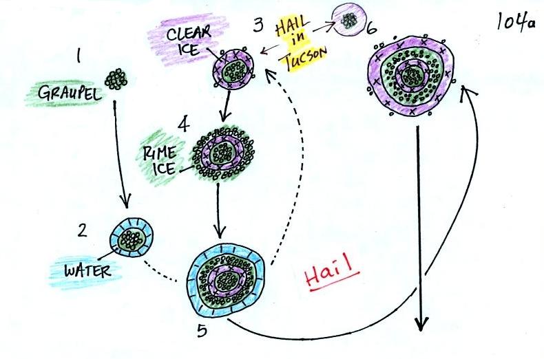
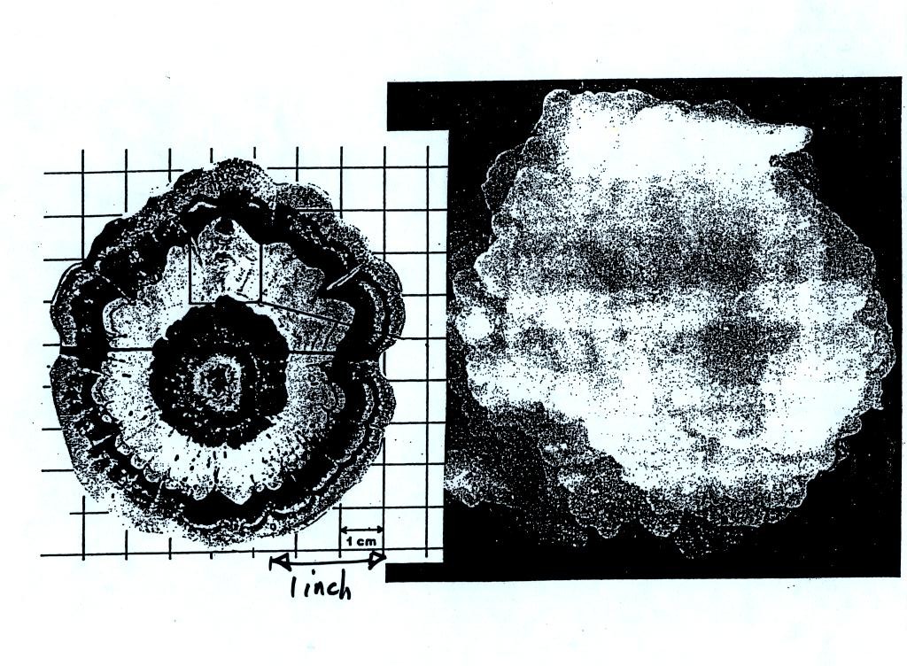
Hail that falls to the ground in Tucson usually just has a graupel core and a single layer of clear ice. In the severe thunderstorms in the Central Plains, the hailstone can pick up additional layers of rime ice and clear ice and hailstones can be composed of many alternating layers of rime and clear ice. An unusually large hailstone (around 3 inches in diameter) has been cut in half to show (below) the different layers of ice. The picture below is close to actual size. If something like this were to hit you in the head it would split your skull open. Here's some pretty good video of a hailstorm in Phoenix.
Hail is produced in strong
thunderstorms with tilted updrafts. You would never
see hail (or graupel) falling from a nimbostratus cloud. Here is
a photo of a record setting 8" diameter hailstone
collected in South Dakota. It is currently the
national record holder. Here's
another hailstone that is almost as big. It
holds the record for Oklahoma.
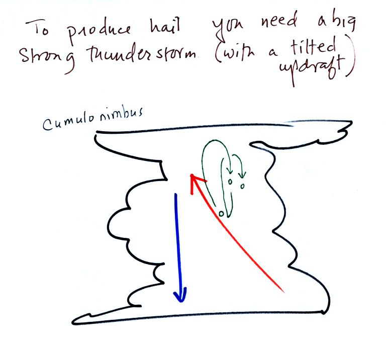
The growing hailstone can fall
back into the updraft (rather than falling out of the cloud)
and be carried back up toward the top of the cloud. In
this way the hailstone can complete several cycles through
the interior of the cloud. The article above mentions
a supercell thunderstorm. We will discuss these later
in the semester.

In the middle picture graupel particles can survive the trip to the ground without melting even in the summer. Many people on the ground would call this hail but that wouldn't be quite right. Graupel is less common in the winter because it comes from thunderstorms and they don't form very often in the winter. Snow can survive the trip to the ground in the winter but not the summer.
Sometimes the falling raindrops will evaporate before reaching the ground. This is called VIRGA and is pretty common early in the summer thunderstorm season in Arizona when the air is still pretty dry. Lightning that comes from thunderstorms that aren't producing much precipitation is called "dry lightning" and often starts brush fires.

Rain will sometimes freeze before reaching the ground. The resulting particle of clear ice is called SLEET. FREEZING RAIN by contrast only freezes once it reaches the ground. Everything on the ground can get coated with a thick layer of ice. It is nearly impossible to drive during one of these "ice storms." Sometimes the coating of ice is heavy enough that branches on trees are broken and power lines are brought down (either by the weight of ice or falling tree limbs). It sometimes takes several days for power to be restored. Here's a gallery of images taken after ice storms.