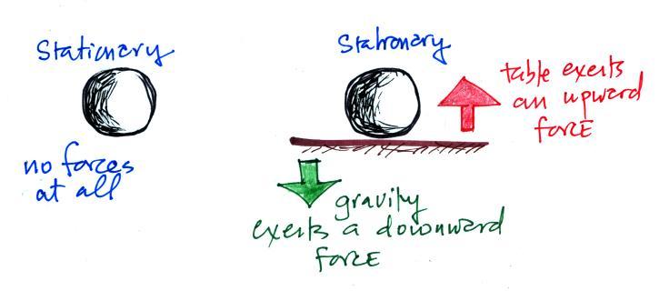
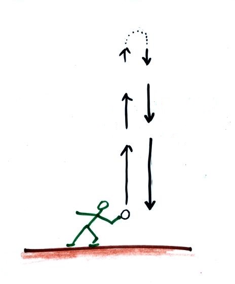
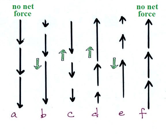
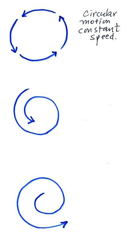
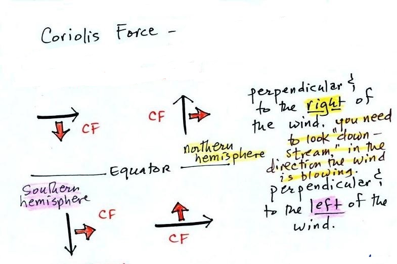
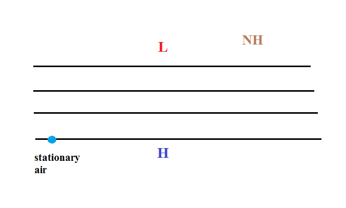
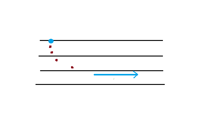
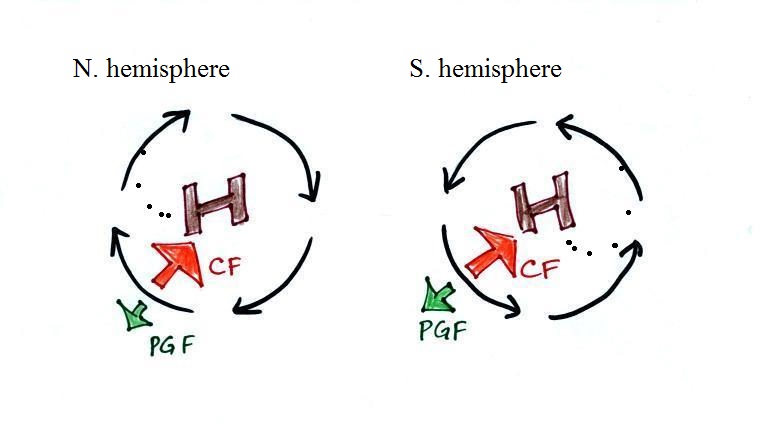
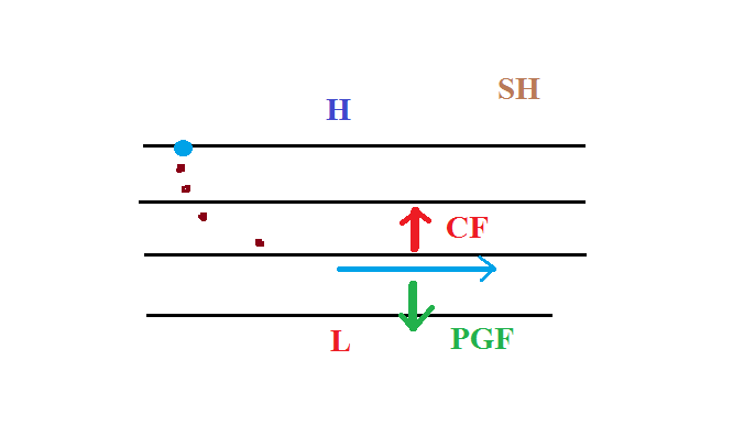
We start with some stationary air
in the lower left corner of the picture. Low
pressure is at the top and high pressure at the bottom
of the picture.
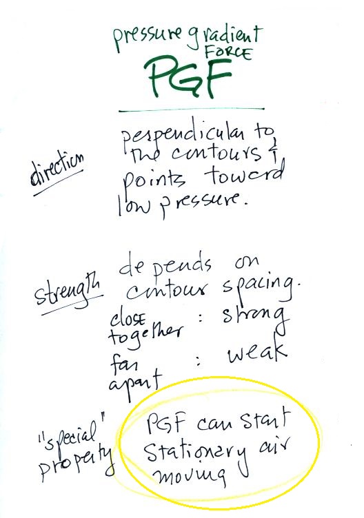
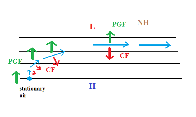
The PGF can start stationary air moving. The PGF
will point toward the top of the picture
(perpendicular to the contours and toward the low
pressure at the top). There won't be any
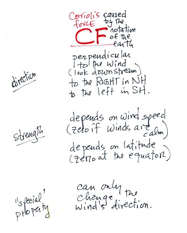
Coriolis force when the air is stationary.
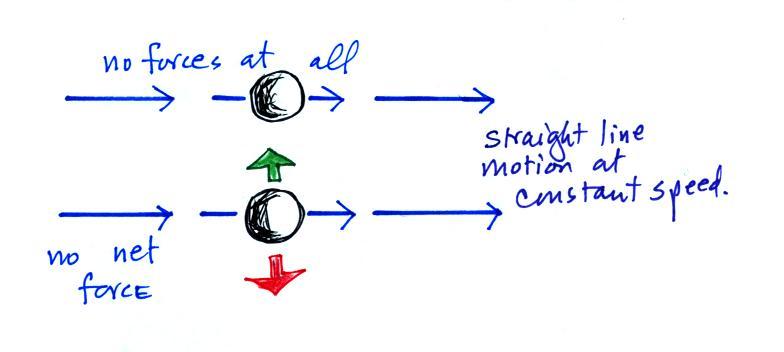
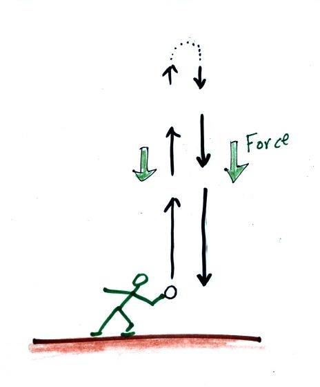
Once the wind starts to blow (blue
line above) the CF will appear. The CF will be
weak at first because the wind speed is low but the CF
will begin to turn the wind to the right. As the
wind picks up speed the CF will increase in
strength. Eventually the wind will be blowing
parallel to the contours from left to right. The
PGF and CF point in opposite directions and are of
equal strength. The net force is zero and the
wind will continue to blow to the right in a straight
line at constant speed.
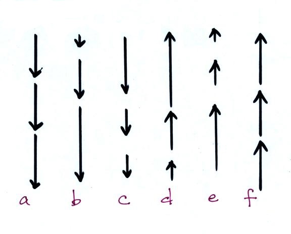
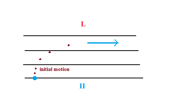
Here's a simpler less cluttered way of depicting
what we have just figured out.
The
dots show the direction of the initial
motion. That will
always be toward low pressure.
Then you look in the direction the
wind starts to blow and look to see
if the wind turns right or
left. It turned right in this
case. That's the effect of the
Coriolis force and means this is a
northern hemisphere map.
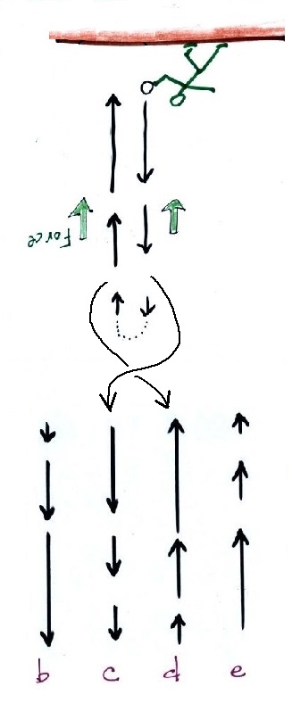
Here's one last example to test your
understanding.
The
direction of the initial motion is shown with
dots. Where is the high and low pressure
in this case? Is this a NH or SH
chart. You'll find the completed map at
the end of today's notes.
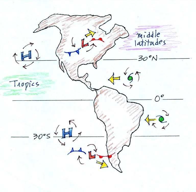
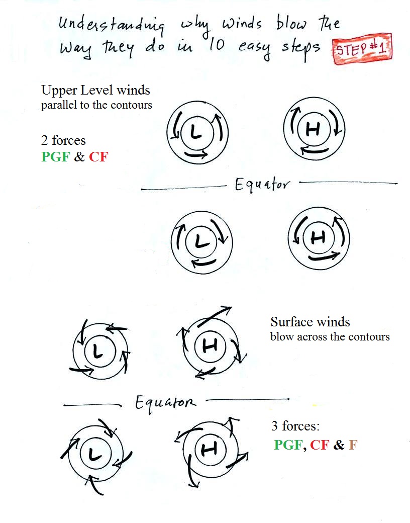
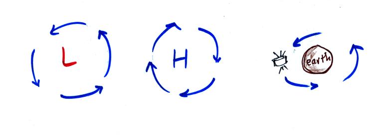
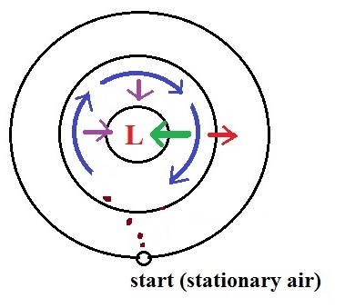
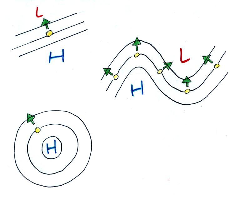
Step #5 - Upper level winds, low pressure, northern
hemisphere
Next we'll be looking at the upper level winds that develop
around circular centers of high and low pressure.
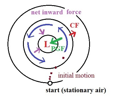
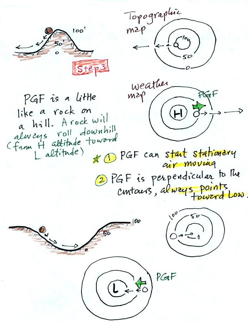
We start with some stationary air at the bottom of the
picture. Because the air is stationary, there is no
Coriolis force. There is a PGF
force, however. The PGF at Point 1 starts
stationary air moving toward the center of low pressure
(just like a rock would start to roll downhill). The
dots show the initial motion
A rock would roll right into the center of the
picture. Once air starts to move, the CF causes it to turn to the
right (because this is a northern hemisphere
chart). As the wind speeds up the CF strengthens. The
wind eventually ends up blowing parallel to the contour
lines and spinning in a counterclockwise direction.
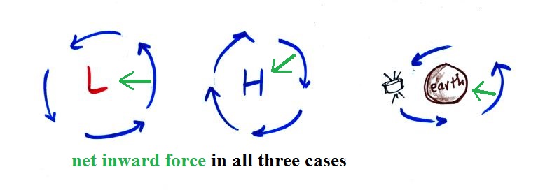
Note that the inward PGF
is stronger than the outward CF.
This results in a net inward force,
something that is needed anytime wind blows in a circular
path.
Upper level winds spin counterclockwise around low
pressure in the northern hemisphere.
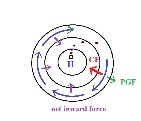
Step #6 - Upper level winds, low pressure, southern
hemisphere
We start again with some stationary air at Point 1 in this
figure. The situation is very similar. Air
starts to move toward the center of the picture but then
takes a left hand turn (the CF
is to the left of the wind in the southern
hemisphere). The winds end up spinning in a clockwise
direction around low in the southern hemisphere. The
directions of the PGF,
CF, and the net inward force are all
shown in the picture.
Upper level winds spin clockwise around low pressure in
the southern hemisphere.
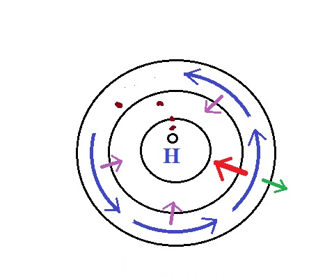
Step #7 - Upper level winds, high pressure,
northern hemisphere
Here initially stationary air near the center of the picture
begins to move outward in response to an outward pointing
pressure gradient force (PGF
is pointing toward low pressure which is on the edges of the
picture). Once the air starts to move, the Coriolis
force (CF) will cause
the wind to turn to the right. The dots show the
initial outward motion and the turn to the right. The
wind ends up blowing in a clockwise direction around the
high. The inward pointing CF
is stronger than the PGF so
there is a net inward force
here just as there was with the two previous examples
involving low pressure. An inward force is need with
high pressure centers as well as with centers of low
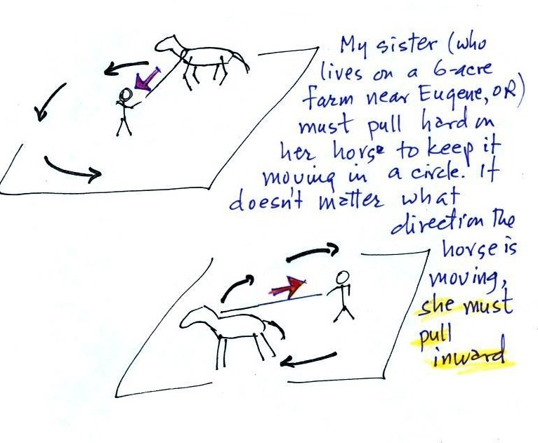
pressure. An inward force is needed anytime something
moves in a circular path.
Step #8 - Upper level winds, high pressure, southern
hemisphere
This is a southern hemisphere upper level center of high
pressure. The air starts to move outward again
but this time takes a left hand turn and ends up spinning
counterclockwise. The net force is inward again.
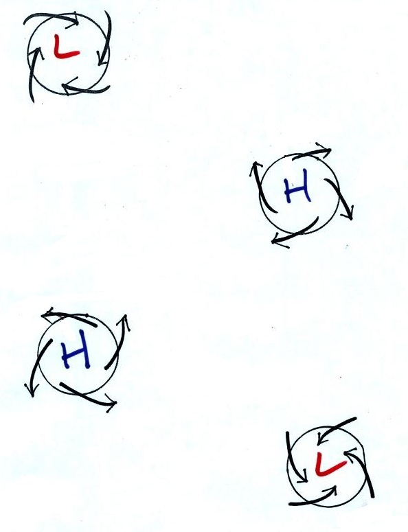
Upper level winds review
Here's a quick review of much of what we have
covered. Many of the figures below were on a handout
distributed in class today.
Winds
spin counterclockwise around L pressure in the
northern hemisphere then switch direction and spin
clockwise around L pressure in the southern
hemisphere. I think by just
remembering a couple of things you can figure this
out rather than just trying to memorize it.
The
pressure gradient will start stationary air moving toward
low pressure (just like a rock placed on a slope will
start to move downhill)
The PGF can start
stationary air moving. The PGF always points
toward low pressure, so the direction of the
initial motion will always be toward low
pressure.
The dots in the figure above show this initial
motion and its in toward the center of the
picture. These must both be centers of Low
pressure.
Once the air starts moving the wind will turn
to the right or left depending on the
hemisphere. This is the effect of
the Coriolis force, the CF turns wind to the
right in the northern hemisphere and to the left
in the southern hemisphere (remember to always
look down stream).
The
northern hemisphere winds are shown at left in
the figure above, the southern hemisphere winds
are shown at right. The inward pointing
force is always stronger than the outward force
so that there is a net inward pointing force.
This initial motion is outward away from the center in
the two figures below.
The outward moving air takes a right turn in the
left figure above, a left turn in the right figure (you
may need to rotate the picture so that you are looking
downstream, in the direction the wind is blowing to
clearly see the left hand turn).
I doubt if we'll even get this far in class on
Tuesday. But I've included Step #9 & #10
below. They complete our work on understanding why
winds blow the way they do
Friction and surface winds
Next we'll try to understand why friction causes surface
winds to blow across the contour lines (always toward low
pressure).
With surface winds we need to take into account the PGF, the
CF, and the frictional force (F). That means
we'll need some rules for the direction and strength of the
frictional force. Friction arises with surface winds
because the air is blowing across (rubbing against) the
earth's surface.

You're probably somewhat familiar with the effects
of friction. If you stop pedaling your bicycle on a flat
road you will slow down and eventually come to a stop due to
air friction and friction between the tires and road
surface. Friction always acts to slow a moving object it
must point in a direction opposite the motion.
The strength of the frictional force depends on wind
speed. The faster you try to go the harder it becomes
because of increased wind resistance. It's harder to
ride on a rough road than on a smooth road surface. In
the case of air there is less friction when wind blows over
the ocean than when the air blows over land. If the wind
isn't blowing there isn't any friction at all.
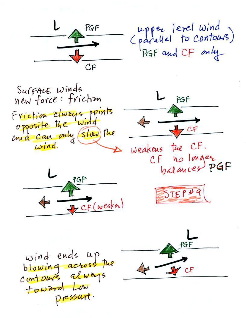
We add friction in the second picture. It points in
a direction opposite the wind and acts to slow the wind
down.
Slowing the wind weakens the CF and it can no longer
balance the PGF (3rd figure). The stronger PGF
causes the wind to turn and start to blow across the
contours toward Low. This is shown in the 4th
figure.
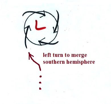
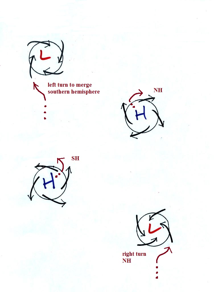
Step #10 - Surface winds blowing around H & L
pressure in the N. & S. hemispheres.
I think you'll be surprised at how
easy it is to determine whether each of the figures below
(p. 129 in the ClassNotes) is a surface center of H or
L pressure, found in the N or S hemisphere,
and whether rising or sinking air motions/clear or
cloudy skies would be associated with each figure.
Key point to remember:
surface winds blow across the contours always toward
low pressure.
It should be very easy to
figure out which two of the figures above are surface
centers of low and high pressure.
Next to determine whether each figure is in the
northern or southern hemisphere we will imagine approaching
the upper left figure in an automobile. We'll imagine
it's a traffic circle and the arrows represent cars instead of
wind.
You're approaching the
traffic circle, what direction would you need to turn
in order to merge with the other cars. In this
case it's left. That left turn is the Coriolis
force at work and tells you this is a southern
hemisphere map.
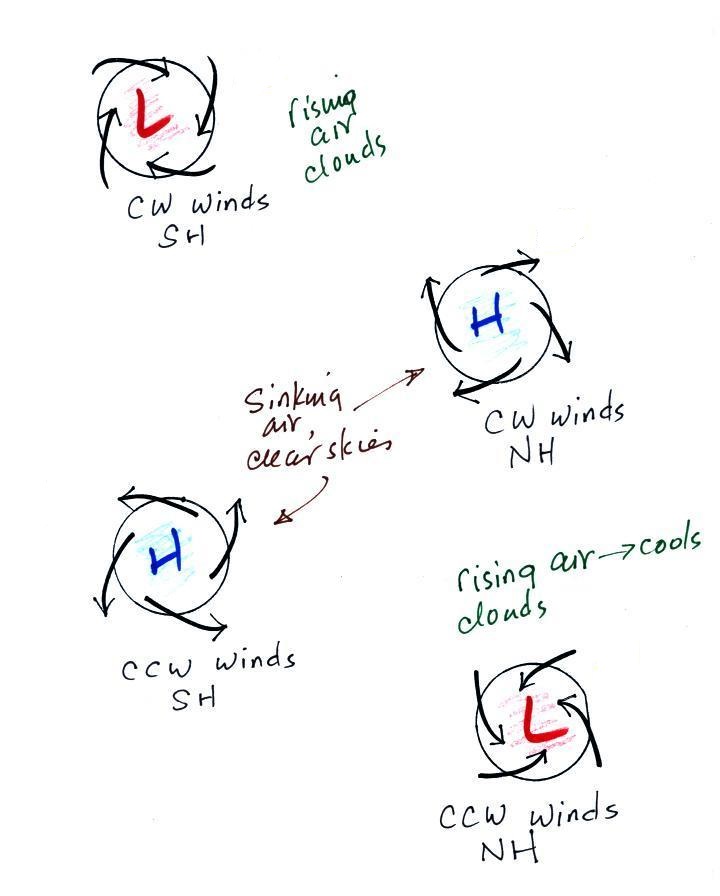
The remaining examples are shown below
Converging winds cause air to rise. Rising air expands
and cools and can cause clouds to form. Clouds and
stormy weather are associated with surface low pressure in
both hemispheres. Diverging winds created sinking wind
motions and result in clear skies.
Somethings change when you move form the northern to the
southern hemisphere (direction of the spinning winds).
Sometimes stay the same (winds spiral inward around centers of
low pressure in both hemispheres, rising air motions are found
with centers of low pressure in both hemispheres).
Here are the answers to the questions on the handout and
embedded in today's notes.