Thursday, Mar. 30, 2006
Please check to see whether your name is on the "you shouldn't be on this list".
These are people that haven't yet turned in reports or don't appear to
be working on a report. A book or experiment report is an
important part of your writing grade. The deadline for turning in
a first draft of a report is Fri., April 14, so you should get working
on a book or experiment as soon as possible. There are probably a
few names on the list that shouldn't be on the list. If you're
one of those people send me an email and I'll promptly remove your name
(and apologize for putting it on the list in the first place).
The Quiz 3 Study Guide is now available
online.
We'll get
some real practice identifying and naming clouds in class today.
It is worth reviewing the 5 key words used to name and describe clouds.

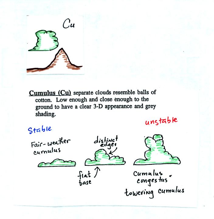
An effective way to learn the 10 cloud names is to draw a table
like the one shown below.
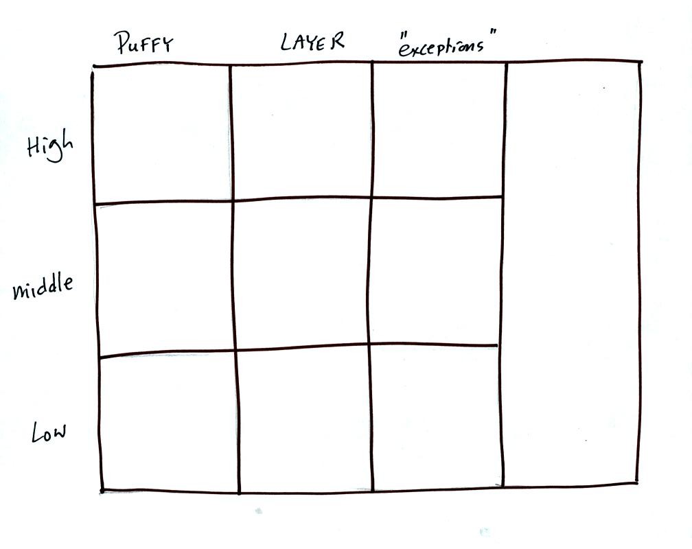
Then fill in each square with an appropriate cloud name and a
sketch of the cloud. You should also be able to describe each
cloud type in words.
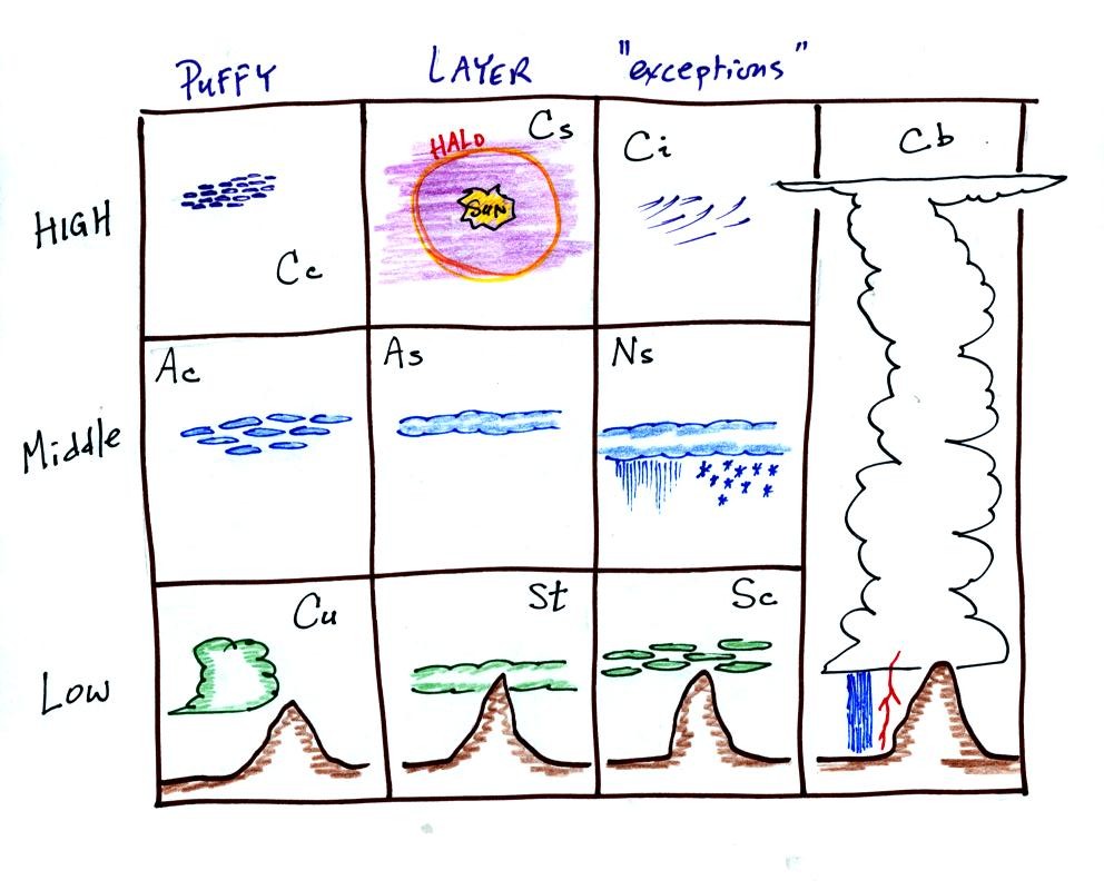
Here is an example of a completed cloud chart.
Next we
looked at photographs of most of the 10 main cloud types. You'll
find the written descriptions of the cloud types on pps 97-98 in the
photocopied notes.
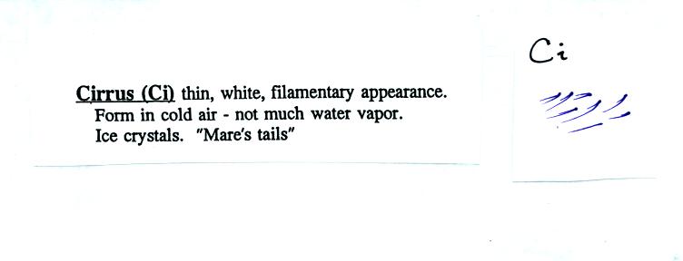
High altitude clouds are thin because the air at high altitudes is
very cold and cold air can't contain much moisture (the saturation
mixing ratio for cold air is very small). If you imagine trying
to paint a Ci cloud you would dip a stiff
brush in white paint brush it quickly and lightly across a blue colored
canvas.
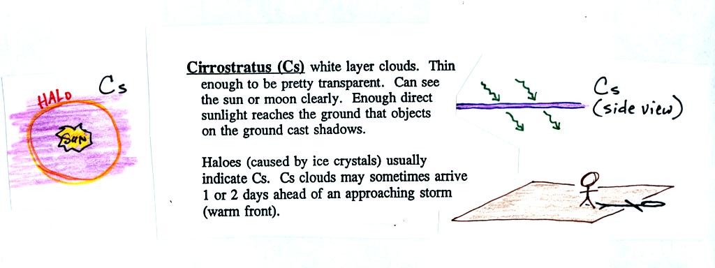
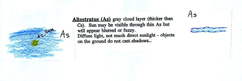
A cirrostratus cloud is a thin uniform white layer cloud covering
part or all of the sky. Here you might first dilute your white
paint with water and then
brush back and forth across the canvas. The thin white paint
might not be thick enough to hide the blue canvas but the white coating
on the canvas would be uniform not streaky like with a cirrus cloud.
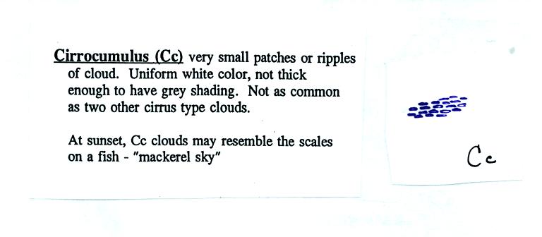
To paint a Cc cloud you would dip a sponge in white paint and
press it gently against the canvas. You would leave a patchy
appearing cloud. It is the patchy (or wavy) appearance that makes
it a cumuliform cloud.
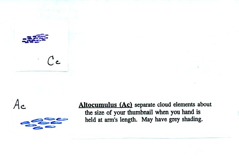
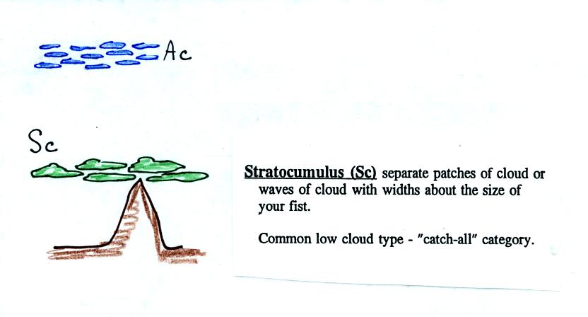
Note since it is hard to accurately judge altitude, you must rely
on cloud element size to determine whether a cloud belongs in the high
or middle altitude category. The cloud elements in Ac clouds
appear larger than in Cc because the cloud is closer to the ground.

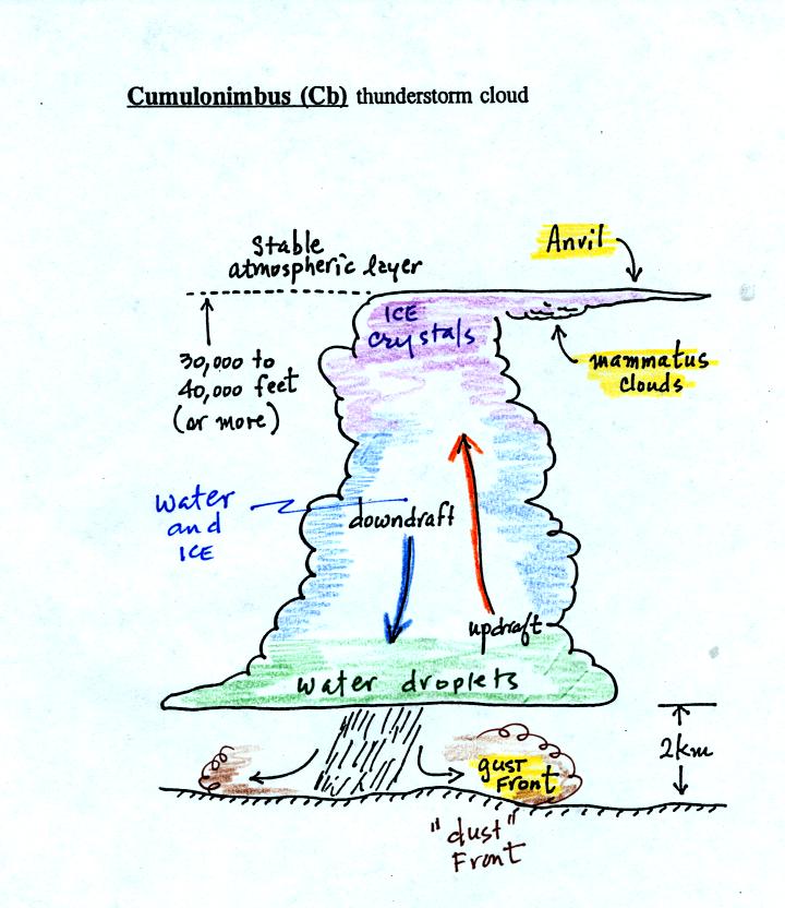
Lots of distinctive features on cumulonimbus clouds.
Horizontal winds behind the gust front can reach 100 MPH or more, most
tornadoes have winds of less than that. Note that both water
droplets and ice crystals exist together in the middle of thunderstorm
clouds (also in nimbostratus clouds) at temperatures below freezing
(the water droplets have a hard time freezing).
Here's one final feature to look for at the bottom of a
thunderstorm.
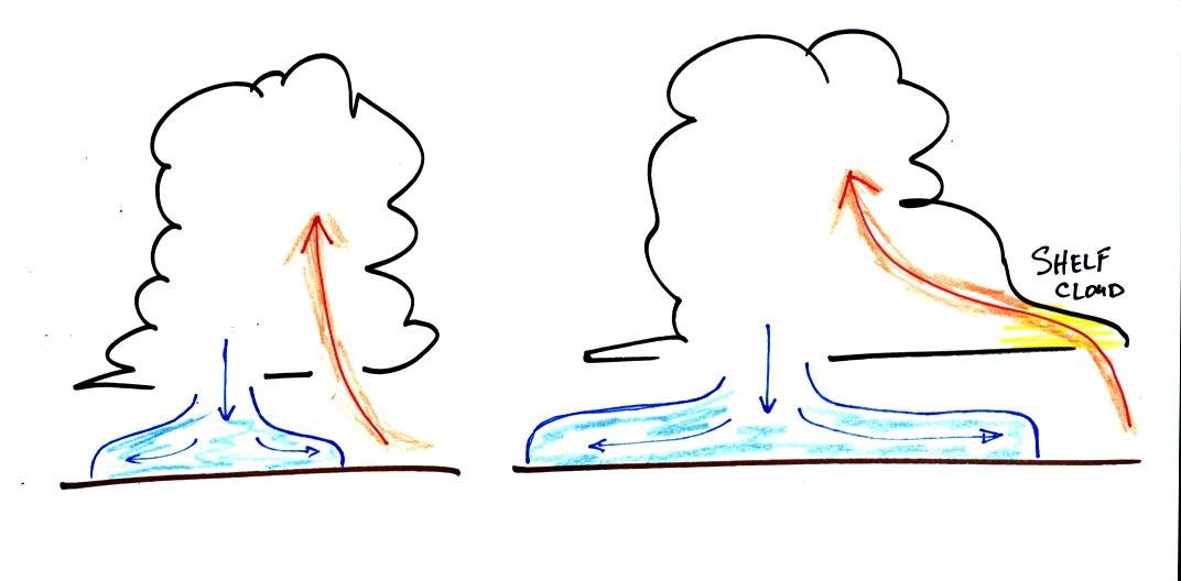
Cold air spilling out of the base of a thunderstorm is just
beginning
to move outward from the bottom center of the storm in the picture at
left. In the picture at right the cold air has moved further
outward and has begun to get in the way of the updraft. The
updraft is forced to rise earlier and a little ways away from the
center of the thunderstorm. Note how this rising air has formed
an extra lip of cloud. This is called a shelf cloud. You'll
find a good photograph of a shelf cloud in Fig. 10.7 in the text.
Next we'll
turn our attention to the formation of precipitation in clouds.
You find this discussed in the second half of Chapter 5 in the textbook.
Only two of the ten clouds types are able to produce significant
amounts of precipitation. It is not that easy to turn small water
droplets or ice crystals into much larger precipitation particles such
as raindrops.
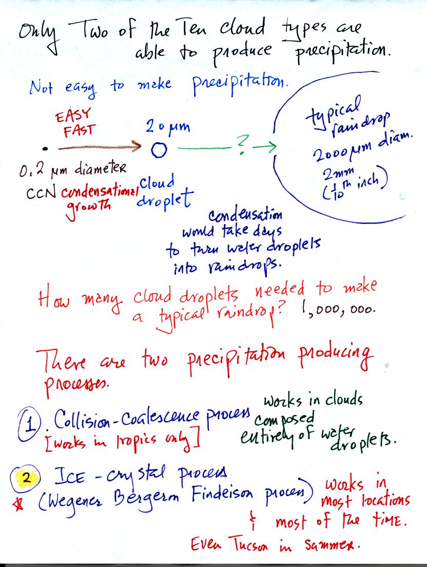
The upper part of the figure shows typical sizes of cloud
condensation nuclei (CCN), cloud droplets, and raindrops. As we
saw in the cloud in a bottle demonstration it is relatively easy to
make cloud droplets. You raise the RH to 100% and water vapor
condenses pretty much instantaneously to form a cloud droplet. It
would take much longer for condensation to turn a cloud droplet into a
raindrop. Part of the problem is that it takes about 1 million
cloud droplets of water to make a raindrop.
There are two processes capable of quickly producing precipitation
sized particles in a cloud.
The collision coalescence process works in clouds that are
composed on water droplets only. Clouds like this are found in
the tropics. We'll see that this is a pretty easy process to
understand.
The ice crystal process produces precipitation in most locations at
most times of the year. This is the process that makes rain in
Tucson, even in the hottest part of the summer.

The collision coalescence process works best in a cloud
filled with cloud droplets of different sizes. As we saw in a
short video the larger droplets fall
faster than the small droplets. The large droplets overtake and
collide with the smaller ones. The droplets then stick together and
form any even larger droplet that will fall faster than before and
sweep out a larger volume. In this accelerating growth process an
above averaged sized droplet can
quickly turn into a raindrop.
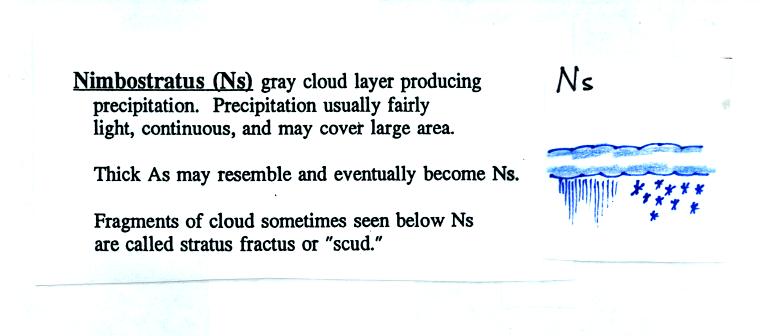
The raindrops that fall from nimbostratus clouds tend to be
smaller
than the raindrops that fall from cumulonimbus clouds. The
growing raindrops don't spend as much time in the Ns cloud because the
cloud is thin and the updrafts are weak. 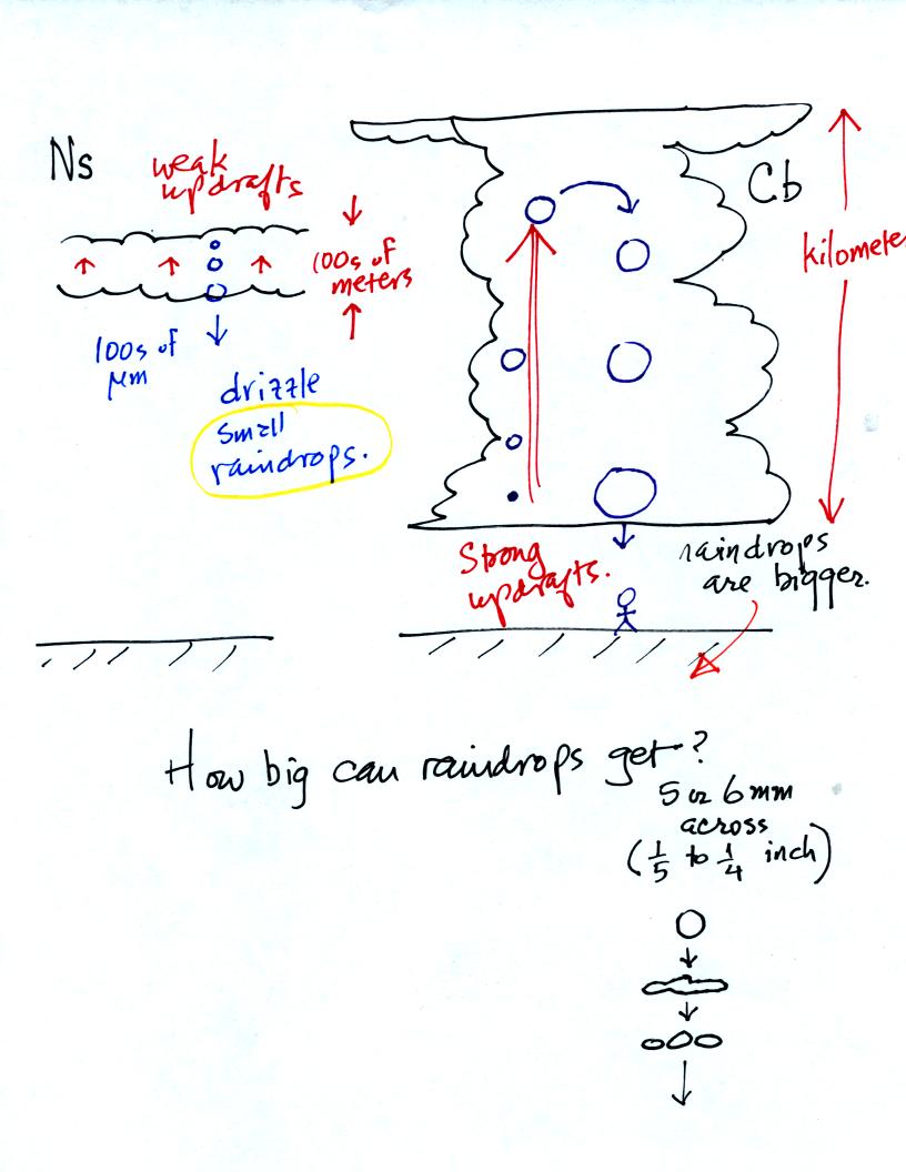
Note raindrops can grow to 5 or 6 mm (1/4 inch) in diameter. The
wind resistance that a large drop encounters as it falls through a
cloud causes it to flatten out, start to flop around or wiggle, and
eventually break into smaller pieces.
You may have noticed a few what seem to be very large raindrops hitting
the ground with an impressive splot at the beginning of a summer
thunderstorm. The figure below (not shown in class) is one
explanation of this phenomenon.
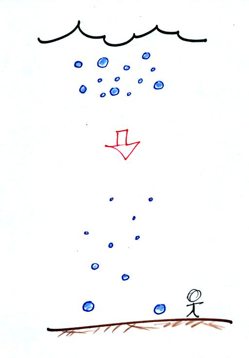
A bunch of raindrops of different sizes leave the bottom of the cloud
together. The larger drops will fall faster and reach the ground
before the smaller drops.