Monday Apr. 28, 2008
The 1S1P Topic #7 (Why the Wind Blows) reports have been graded.
So have the In class Optional Assignments from last Friday.
Answers
will appear online sometime Tuesday.
Quiz reviews this afternoon and tomorrow afternoon. See the Quiz
#4 Study Guide for time and locations. There has been a small
change to the Study Guide. A very small amount of material was
removed.
I had an interesting time at the Stevie Eller Dance Theater last
Saturday night. Click here
for more information.
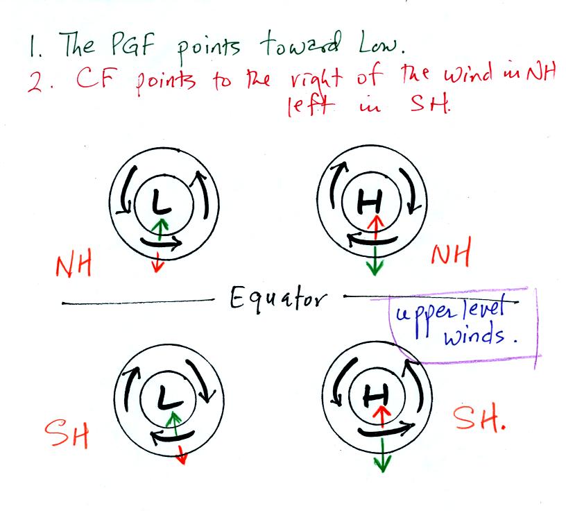
The figure above shows that if you just remember that the PGF points
toward low pressure and that the CF is the right and left of the wind
in the northern and southern hemispheres, you could easily figure out
which hemisphere each of the examples above belongs in.
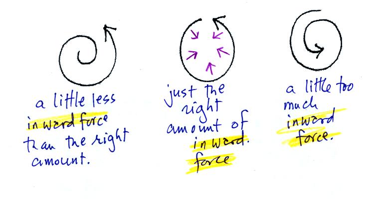
This question on the optional assignment caused a lot of people some
problems. The net force is inward in all three cases.
Today we
will cover the last section on the Quiz #4 Study Guide: 3-cell model
features. The features referred to are large scale (global scale)
pressure belts and surface winds found on the earth. Don't worry
about what the term "3-cell" is referring to.
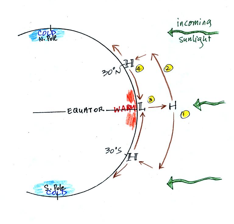
This figure tries to explain the origin of the surface high and low
pressure belts that we will be looking at.
First incoming sunlight strikes the equator perpendicularly. It
strikes the poles at a steep angle. The equator and the air above
the equator becomes warmer than at higher latitudes.
1. Pressure will decrease with increasing altitude above
the equator. The rate of pressure decrease will be relatively
slow in the warm low density air. As a result you end up with
high pressure at upper levels (not higher than at the surface but
higher than the pressure you would find at the same altitude to the
north or south).
2. Upper level winds will be begin to blow away from the
equator and toward he north and south.
3. As soon as air begins to blow north and south from Point
1(air is being removed from the atmosphere above the equator), the
surface air pressure at Point 3 will decrease.
Note this is
exactly the same thing that happens with huricanes. High pressure
and diverging winds at the top center of the hurricane lower the
surface pressure at the bottom center of the hurricane.
Surface winds converge and the storm intensifies.
4. Air moving north and south from Point 1 won't travel all
the way to the poles. As soon as the air starts to head north or
south and away from the equator it will be bent by the Coriolis
force. By the time it gets to 30 degrees latitude, the wind is
blowing parallel to the lines of latitude. As upper level winds
add air to the atmosphere above 30 degrees latitude the surface
pressure will start to increase.
5. Suface winds begin to blow from high pressure near 30
degrees toward lower pressure at the equator.
Here are
the surface features.

You should be able to start with a blank sheet of paper and
reproduce this figure. Really.
Start by drawing in the low pressure belt at the equator. This is
called the Equatorial low.
Then draw in belts of high pressure at 30 N and 30 S. These are
the subtropical highs.
Draw in surface winds blowing from high pressure toward low
pressure. Once the winds start to blow, the Coriolis force will
cause them to bend (to the right in the northern hemisphere, to the
left in the southern hemisphere, be sure to look in the direction the
wind is blowing).
You will find easterly winds in the subtropics. These are the Trade
winds. They converge at the Equator producing the intertropical
convergence zone (ITCZ). This is a cloudy region on the earth
(the converging winds cause air to rise). Sailing ships would
sometimes lose their wind in the doldrums and be stuck out in the open
ocean without enough food (they could collect rain water to drink).
Westerly winds, the prevailing westerlies are found north of 30 N and
south of 30 S.
The "horse latitudes" centered at 30 N is another region of calm
surface winds. Sailing ships would lose their winds and become
stranded. This time there wasn't a ready supply of fresh
water. The term horse latitudes refers to a situation where the
horses were either eaten or thrown overboard rather than being allowed
to drink fresh water.
Hurricanes form in the subtropics and move from east to west.
Middle latitude storms form at higher latitude and move from east to
west (note the middle latitude storm in the southern hemisphere is
misplaced. It should be south of 30 S)
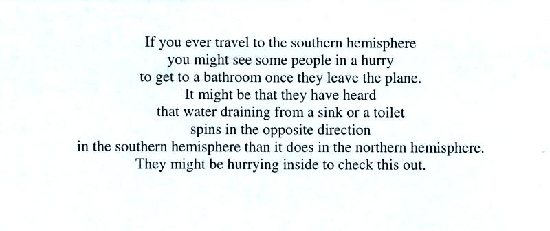
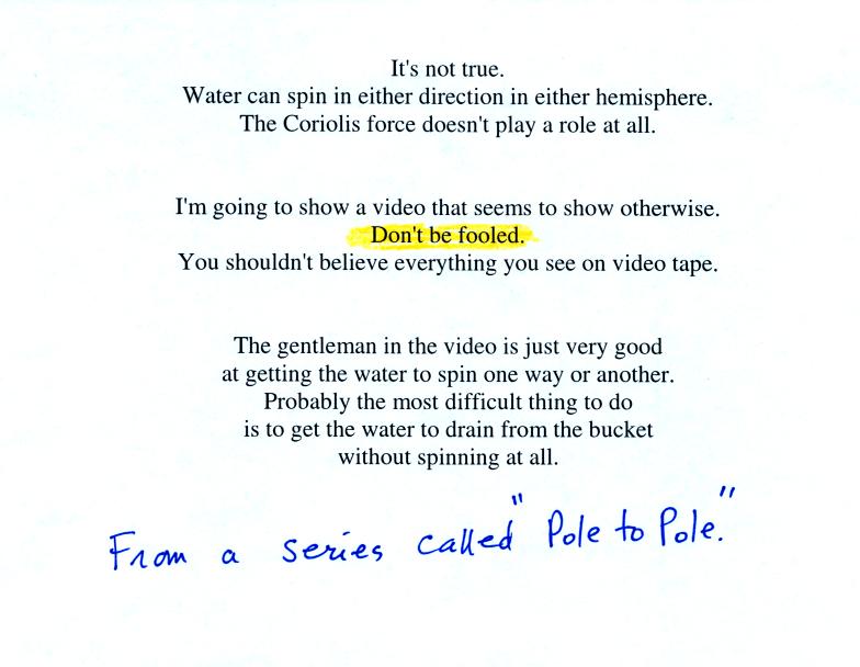
We spent
the last few minutes of the class discussing a common misconception -
that water drains from sinks and toilets spinning in one direction in
the northern hemisphere and in the other direction in the
southern hemisphere.