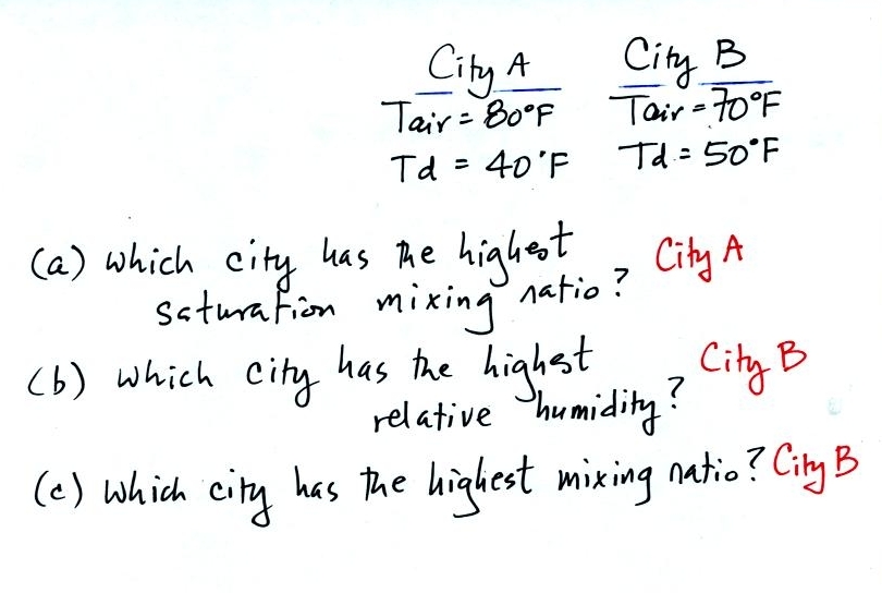
In (a) the saturation mixing ratio depends on air
temperature. Warm air has a higher saturation mixing ratio than
cold air. So City A with a temperature of 80 F will have a higher
saturation mixing ratio than City B.
In (b) you must look at the different between Tair and Td. A
small difference will mean the RH is high (remember if the Tair = Td
the RH is 100%). So City B where the difference is 20 F has a
higher RH than City A where the difference is 40 F.
Dew point and mixing ratio have the same job, telling you how much
water vapor is in the air. A high dew point means a high mixing
ratio. So City B with a 50 F dew point has more water vapor in
the air and a higher mixing ratio than City A.
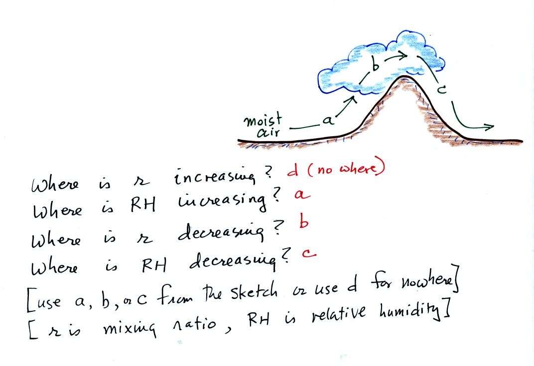 As the
moist air begins to move up the side of the mountain along Path (a) it
will expand and cool. Initially the RH of the air is less than
100%. The RH will increase along Path (a) as the air cools until
the RH reaches 100%, that is where the cloud base becomes visible.
As the
moist air begins to move up the side of the mountain along Path (a) it
will expand and cool. Initially the RH of the air is less than
100%. The RH will increase along Path (a) as the air cools until
the RH reaches 100%, that is where the cloud base becomes visible.
The air continues to rise, expand, and cool along Path (b). The
RH will remain constant at 100%. Cooling air below its dew point
causes water vapor to condense and fall to the ground as rain.
Water vapor is removed from the air and the mixing ratio will decrease
along Path (b).
The air sinks along Path (c), this will warm the air and lower the
RH. The cloud disappears when the RH drops below 100%. No
water vapor is being added to the air as it moves along Path (c) so the
mixing ratio won't change.