Tuesday April 14, 2015

Andrew Bird "My Sister's Tiny Hands", Gotye "Somebody That I Used to Know", Radiohead "Reckoner", Rhiannon Gibbens "Shake Sugaree" and "Spanish Mary".

The 1S1P Causes of the Seasons reports have finally been graded and were returned in class today.  The Satellite Photographs of Clouds reports were collected today.

Some of the Experiment, Book & Scientific Paper reports turned in last Thursday before the quiz have been graded.  Those that haven't been graded together with the Expt. #2 revised reports will be returned on Thursday.

An Optional Assignment was handed out today.  You can download a copy of the assignment here.  It is due Tuesday next week (Apr. 21).


Today and briefly on Thursday we will be looking at how and why surface and upper level winds blow the way they do.

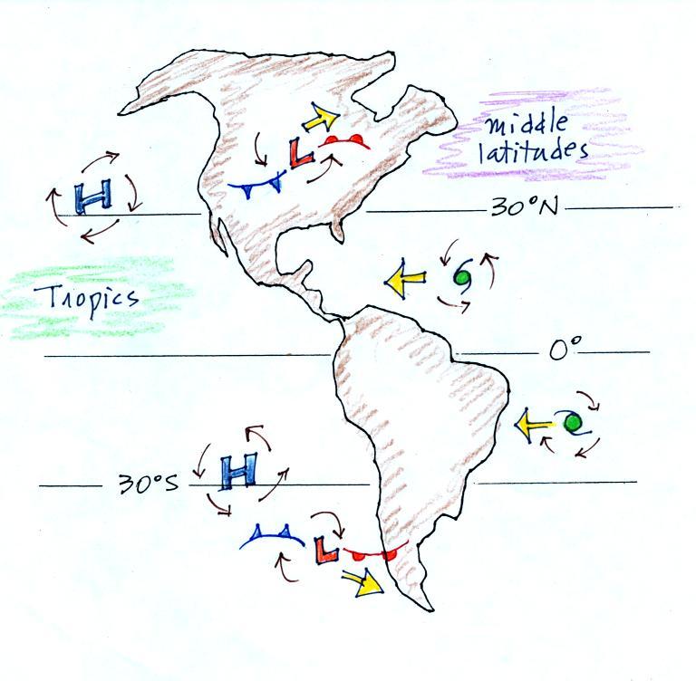
Some real world examples of where this occurs are shown in the figure below (found on p. 121 in the ClassNotes).  The two largest types of storm systems, middle latitude storms (extratropical cyclones) and hurricanes (tropical cyclones), develop around surface centers of low pressure (the term cyclone refers to winds blowing around a center of low pressure).  Winds spin counterclockwise around cyclones (centers of low pressure) in the northern hemisphere and clockwise in the southern hemisphere.  This is the point in the class that the southern hemisphere makes its appearance.

Winds spin clockwise around "anticyclones" (high pressure) in the northern hemisphere and counterclockwise in the southern hemisphere.

Why do winds blow in opposite directions around high and low pressure.  Why do the winds change directions when you move from the northern to the southern hemisphere.  These are the kinds of questions we'll be addressing.


Something else to notice in the figure.  Storm systems in the tropics (0 to 30 degrees latitude) generally move from east to west in both hemispheres.  At middle latitudes (30 to 60 degrees), storms move in the other direction, from west to east.  That's not something we will cover in class, though it may be covered in a 1S1P topic.


We'll be able to learn most of what we need to know about surface and upper level winds in 10 relatively easy steps (though I've broken several of the steps into smaller parts)

Step #1 - Upper level and surface winds - summary

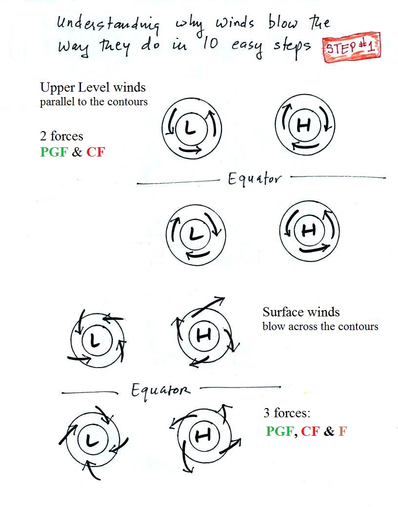
Here's a slightly different version of p. 122a in the ClassNotes.


Upper level winds spinning around high and low pressure in the northern and southern hemispheres are shown in the first set of four pictures.  All the possibilities are here.  The first thing to notice is that upper level winds blow parallel to the contours.  Just 2 forces, the pressure gradient force (PGF) and the Coriolis force (CF), cause the winds to blow this way.  Eventually you will be able to draw the directions of the forces for each of the four upper level winds examples.  Here is an upper level wind example showing what you will be able to do. 

The four drawings at the bottom of the page show surface winds blowing around high and low pressure in the southern hemisphere.  These winds blow across the contour lines slightly, always toward low pressure.  A third force, the frictional force is what causes this to occur.
  He is an example of what you will be able to say about surface winds.


Step #2 - Newton's 1st law of motion


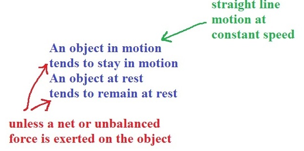
If there's no force being exerted on an object it will either be stationary or moving in a straight line at constant speed.  Anytime an object is slowing or speeding up or changing direction (or both) a net force is present.

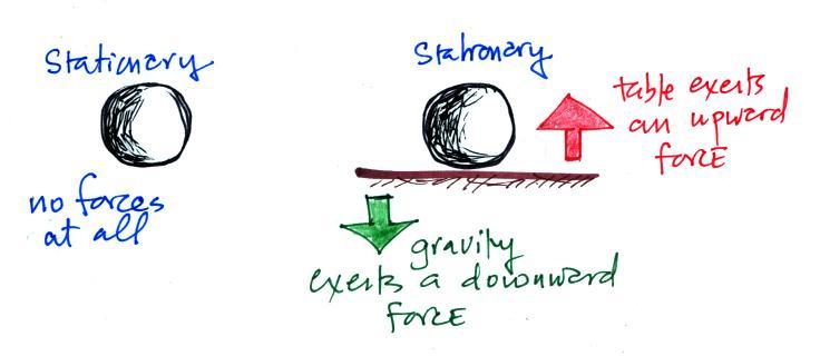
You should be able to look at an object's (or the wind's) motion and tell if there is a net force or not.  There are two situations where there is no net force.  The first is shown below.


The two objects above are stationary.  In both cases there is no net force.  That could mean there aren't any forces at all (left figure).  Or forces may be present but they cancel each other out and add up to zero (the total force is zero).  With zero net force both objects will remain stationary.

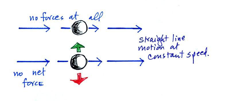
The other possibility is that something is moving in a straight line at constant speed.


As long as the net force remains zero both objects will continue to move in a straight line at constant speed.  Note in the bottom figure the two forces could have been pointing right and left.  If they cancel each other out the total force is zero and the object would continue to move in a straight line at constant speed.

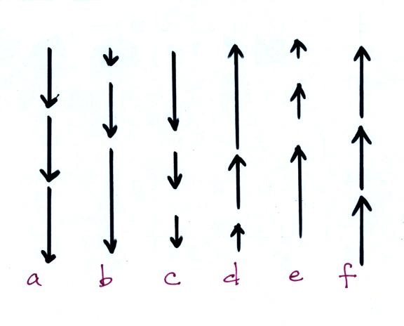
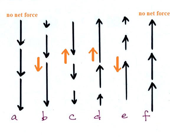
Here are some more examples of straight line motion (this and 3 additional figures was on a handout distributed in class).


Straight motion in all 6 cases.  The speed is also constant in examples (a) and (f) so there is no net force in those two cases only.  The speed is changing in all the other situations.  A net force is present in (b) - (e) and you should be able to determine its direction.  Maybe you can figure that out just by looking at the pictures, maybe not.  What you might do is think of a situation you are familiar with.


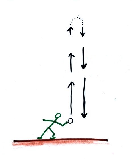
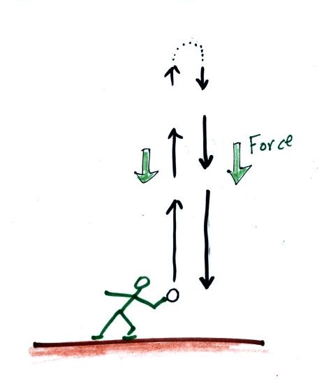
Here's a picture of someone throwing a ball upward.  You know from personal experience that the downward force of gravity will cause the ball to slow down as it rises, come to a stop, and then begin to fall picking up speed as it fallsGravity is present during both the rise and fall of the object.

We can use this motion that we understand to figure out the direction of the net forces in the earlier picture.


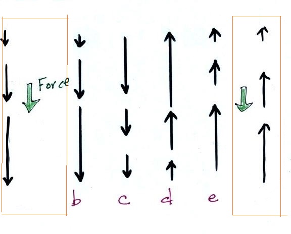
Notice how the motion in (b) resembles that of a falling ball.  The motion in (e) is just like the motion of the ball thrown upward in the air.
  In this kind of way you can figure out and draw in the directions of the forces present in all 4 examples (b) - (e).


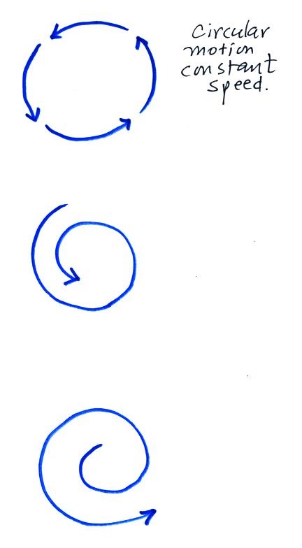
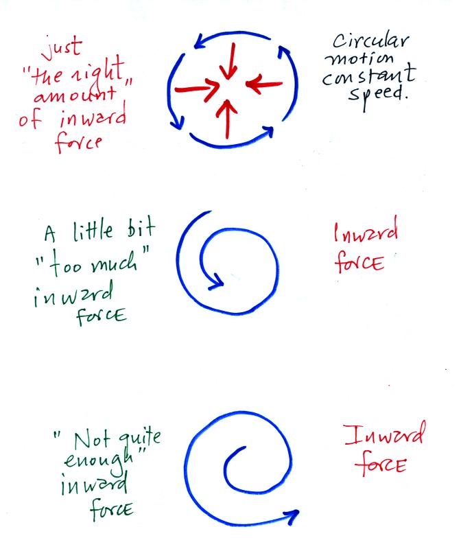
The next figure shows circular motion at constant speed.  Is there a net force in any of these examples?  The answer is yes, a net force is present in all three cases because the motion is not straight line motion at constant speed.  What is the direction of the net force?


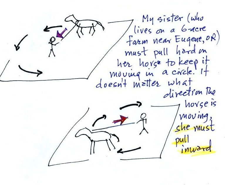
My sister can help with this question


She's out longeing ones of her horses, training it to run in a circle and to obey her commands.  At least initially the horse doesn't really want to do that and you must pull with a lot of force to keep it moving in a circle (without a force it would move in a straight line).  It's relatively easy to understand when you imagine a strong heavy horse at the end of a rope but a net inward force is needed anytime anything moves in a circular path.


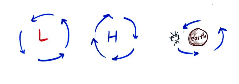
It doesn't matter what the direction of spin is, it doesn't matter what's in the middle of the picture, anytime something is moving in a circle there is a net inward force (gravity is the inward force keeping the satellite in orbit in the 3rd picture).

Here's a question I know many people will have trouble with (but better to have trouble here in the online notes than in the middle of a quiz).  Keeping an image of a horse on the end of a longe line might help.


Is there a net inward or outward force in each case?  You should now know that there is a net inward force in the 1st example because that's what we've just been covering.  What about the next two.  The 3rd example is the one that causes people the most trouble.  You'll find the answer to this question at the end of today's notes.


Now we'll start to look at the forces that cause the wind to blow.
Step #3
Pressure Gradient Force (PGF
The figure below is on p. 123a in the ClassNotes)


Isobars on a weather map are very much like height contours on a topographic map.  A center of low pressure on a weather map is analogous to a circular valley on a topographic map (high pressure on a weather chart is like a circular hill).

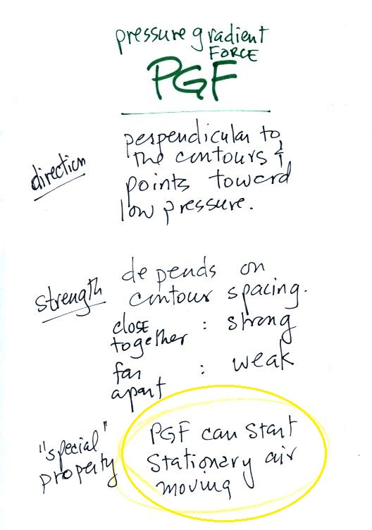
The PGF always points in a direction that is perpendicular to the contour lines and toward low pressure.  The PGF can start stationary air moving.  The air will always start moving toward low pressure.  Air moving inward toward low pressure or outward away from high pressure is similar to a rock rolling downhill into the center of a depression or downhill and outward away from the summit of a hill.


It's good to understand the pressure gradient force as best you can.  But at the same time it's nice to have some rules that you can fall back on and apply.  The rules for the PGF are shown above.  Follow them (especially the one for direction) to the letter and you'll never go wrong.

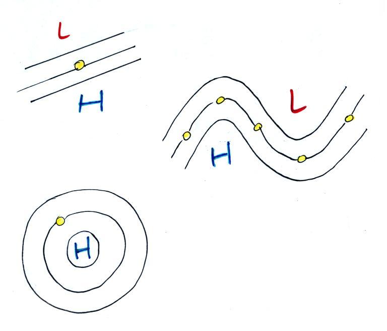
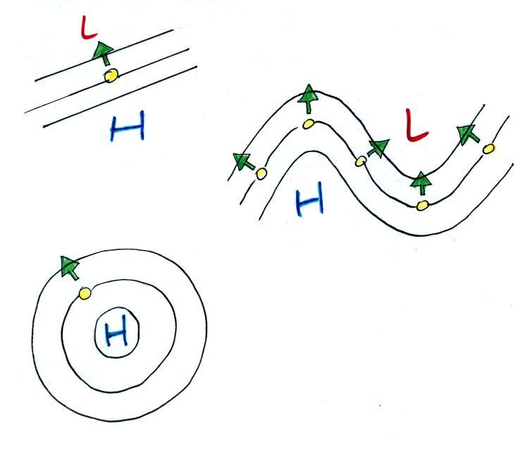
Use the following figure to test yourself.  With an arrow draw the direction of the PGF at each of the points in the figure.  You'll find the answers at the end of today's notes.


Step #4 - Coriolis force (CF)
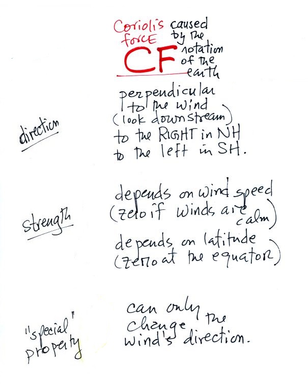
The rules for the CF are shown below.


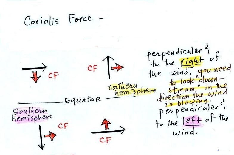
The top of p. 123b in the ClassNotes has several examples showing the direction of the CF.  You can use them to check and make sure you understand how to apply the direction rule above.


The Coriolis force is caused by the rotation of the earth.  I've put a little information about the cause of the Coriolis Force at the end of today's notes.  We didn't cover that in class today.  The CF points perpendicular to the wind and is to the right or left depending on hemisphere.  Be sure you are looking in the direction the wind is blowing, looking downstream when determining the direction of the CF. 

The CF can only change the wind's direction.  It can't cause the wind to speed up or slow down. 


There isn't any Coriolis force when the wind is calm.  Coriolis force is zero at the equation because that's where the CF changes direction.  Hurricanes don't form at the equator because there is no Coriolis force there.


Time now to begin to apply what we've learned so far.

We'll consider the simplest possible situation - upper level winds with straight contours.  We'll do a Northern Hemisphere (NH) example.


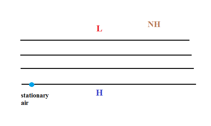
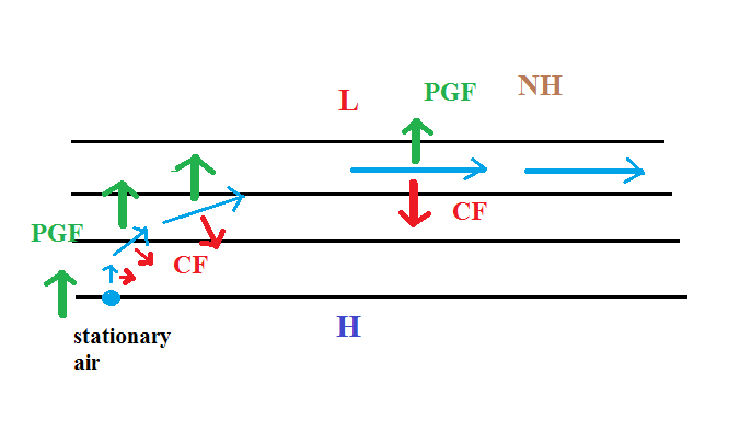
We start with some stationary air in the lower left corner of the picture.  Low pressure is at the top and high pressure at the bottom of the picture.

The PGF can start stationary air moving.  The PGF will point toward the top of the picture (perpendicular to the contours and toward the low pressure at the top).  There won't be any Coriolis force when the air is stationary.

Once the wind starts to blow (blue line above) the CF will appear.  The CF will be weak at first because the wind speed is low but the CF will begin to turn the wind to the right.  As the wind picks up speed the CF will increase in strength.  Eventually the wind will be blowing parallel to the contours from left to right.  The PGF and CF point in opposite directions and are of equal strength.  The net force is zero and the wind will continue to blow to the right in a straight line at constant speed.

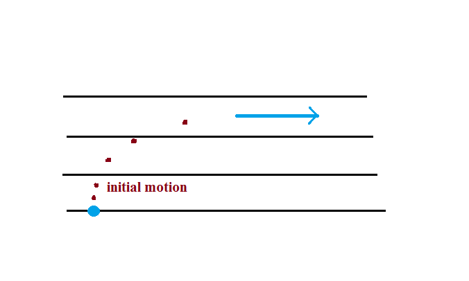
Here's a simpler less cluttered way of depicting what we have just figured out.


The dots show the direction of the initial motion.  That will always be toward low pressure.  Then you look in the direction the wind starts to blow and look to see if the wind turns right or left.  It turned right in this case.  That's the effect of the Coriolis force and means this is a northern hemisphere map.

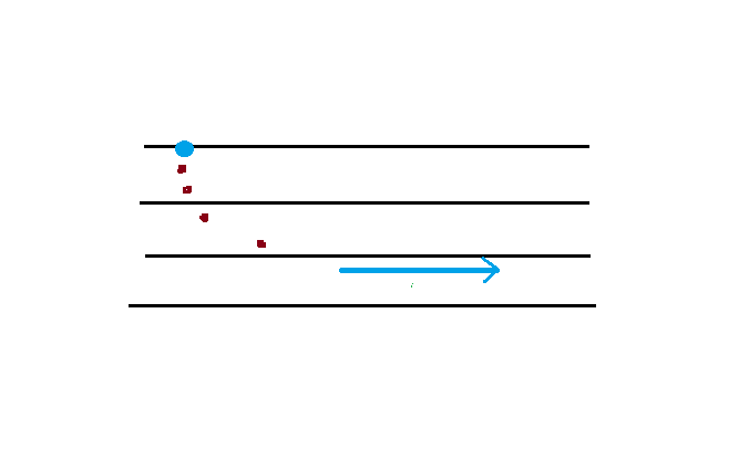
Here's one last example to test your understanding.


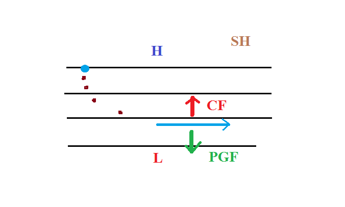
The direction of the initial motion is shown with dots.  Where is the high and low pressure in this case?  Is this a NH or SH chart.  You'll find the completed map at the end of today's notes.


Step #5 - Upper level winds, low pressure, northern hemisphere

Next we'll be looking at the upper level winds that develop around circular centers of high and low pressure.
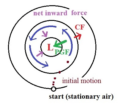


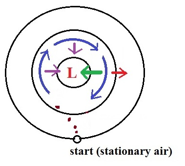
We start with some stationary air at the bottom of the picture.  Because the air is stationary, there is no Coriolis force.  There is a PGF force, however.  The PGF at Point 1 starts stationary air moving toward the center of low pressure (just like a rock would start to roll downhill).  The dots show the initial motion

A rock would roll right into the center of the picture.  Once air starts to move, the CF causes it to turn to the right (because this is a northern hemisphere chart).    As the wind speeds up the CF strengthens.  The wind eventually ends up blowing parallel to the contour lines and spinning in a counterclockwise direction.  Note that the inward PGF is stronger than the outward CF.  This results in a net inward force, something that is needed anytime wind blows in a circular path.


Upper level winds spin counterclockwise around low pressure in the northern hemisphere.


Step #6 - Upper level winds, low pressure, southern hemisphere


We start again with some stationary air at Point 1 in this figure.  The situation is very similar.  Air starts to move toward the center of the picture but then takes a left hand turn (the CF is to the left of the wind in the southern hemisphere).  The winds end up spinning in a clockwise direction around low in the southern hemisphere.  The directions of the PGF, CF, and the net inward force are all shown in the picture.


Upper level winds spin clockwise around low pressure in the southern hemisphere.


Step #7 - Upper level winds, high pressure, northern hemisphere


Here initially stationary air near the center of the picture begins to move outward in response to an outward pointing pressure gradient force (PGF is pointing toward low pressure which is on the edges of the picture).  Once the air starts to move, the Coriolis force (CF) will cause the wind to turn to the right.  The dots show the initial outward motion and the turn to the right.  The wind ends up blowing in a clockwise direction around the high.  The inward pointing CF is stronger than the PGF so there is a net inward force here just as there was with the two previous examples involving low pressure.  An inward force is need with high pressure centers as well as with centers of low pressure.  An inward force is needed anytime something moves in a circular path.


This is about as far as we got in class today, but I'm going to include one more figure to complete the material on upper level winds.  We'll take care of surface winds (Steps 9 and 10 in class on Thursday)

Step #8 - Upper level winds, high pressure, southern hemisphere
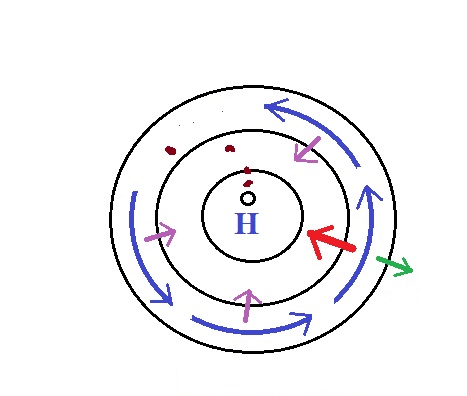


This is a southern hemisphere upper level center of high pressure. The air starts to move outward again but this time takes a left hand turn and ends up spinning counterclockwise.  The net force is inward again.


Here are the answers to the questions on the class handout and embedded in today's notes.


A net inward force is needed in all three cases.  The thing that changes is the strength of the inward force.


This figure shows the directions of the PGF at each of the highlighted points.  The mistake many people make is to draw the arrow pointing straight toward the L.  But the PGF arrow must also always be perpendicular to the contour lines.


The initial motion is always toward L pressure which must be at the bottom of this map.  Then if you turn the map so that you can look downstream in the direction of the initial motion you'll notice the wind turning to the left indicating this is a southern  hemisphere map.