Wednesday Oct. 24, 2007
1S1P Assignment #2 reports were collected today.
Quiz #3 is one week from today (Wed., Oct. 31). The complete Quiz #3 Study Guide is now online.
The Experiment #3 reports are due next Monday. Please try to
return your materials by Friday, the experiment materials are needed
for another class next week. Once you return the materials you
can pick up a copy of the supplementary information sheet.
Computer generated grade summaries were distribted in class
today. Please verify that the information recorded on your grade
summary is correct.
We didn't
finish the discussion of satellite photographs in class on
Monday. Quite a bit of
additional information was added to the Mon. Oct. 22 notes that was not covered in class.
Today we
will first look at 35 mm slides of most of the 10 cloud types.
Good
photographs of the ten cloud types can also be found in Chapter 4 of
the text and in a Cloud Chart at the end of the textbook. You'll
find the written descriptions of the cloud types in the images below on
pps 97-98 in the
photocopied notes.

High altitude clouds are thin because the air at high
altitudes is
very cold and cold air can't contain much moisture (the saturation
mixing ratio for cold air is very small). These clouds are also
often blown around by fast high altitude winds. Filamentary means
"stringy" or streaky. If you imagine trying
to paint a Ci cloud you would dip a stiff
brush in white paint brush it quickly and lightly across a blue colored
canvas.

A cirrostratus cloud is a thin uniform white layer
cloud
(not purple as shown in the figure) covering
part or all of the sky. Here you might first dilute your white
paint with water and then
brush back and forth across the canvas. The thin white paint
might not be thick enough to hide the blue canvas but the white coating
on the canvas would be uniform not streaky like with a cirrus cloud.

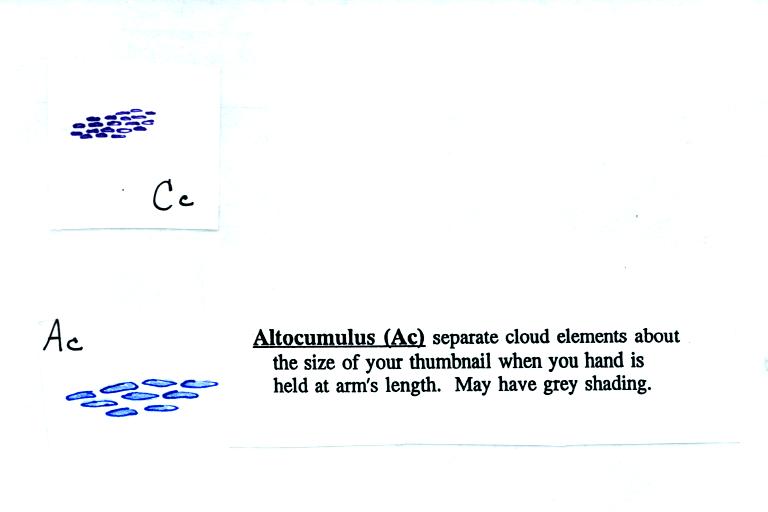
To paint a Cc cloud you would dip a sponge in white paint
and
press it gently against the canvas. You would leave a patchy,
splotchy
appearing cloud (sometimes you might see small ripples). It is
the patchy (or wavy) appearance that makes
it a cumuliform cloud.

Note since it is hard to accurately judge altitude, you must
rely
on cloud element size to determine whether a cloud belongs in the high
or middle altitude category. The cloud elements in Ac clouds
appear larger than in Cc because the cloud is closer to the ground.
Lenticular clouds (see Fig. 4.33 on p. 105 in the text) are a special
type of altocumulus cloud.

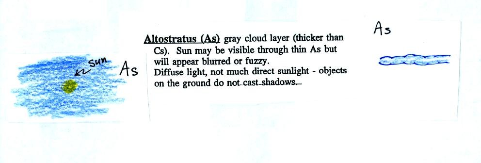
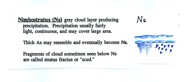
When (if) an
altostratus cloud begins to produce precipitation, its name is changed
to nimbostratus.


This cloud name is a little unusual because the two key
words for cloud
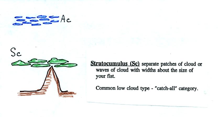
appearance have been combined. Because they are closer to the
ground, the separate patches of Sc are about fist size. The
patches of Ac, remember, were about thumb nail size.

There weren't any examples of stratus clouds in the slide
collection.

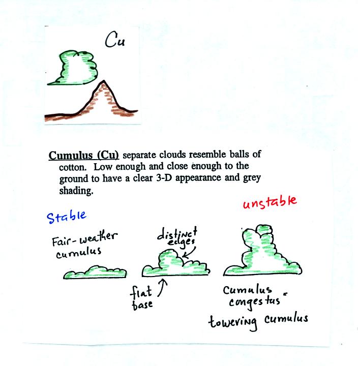
Cumulus clouds come with different degrees of vertical
development. The fair weather cumulus clouds don't grow much
vertically at all. A cumulus congestus cloud is an intermediate
stage between fair weather cumulus and a thunderstorm.

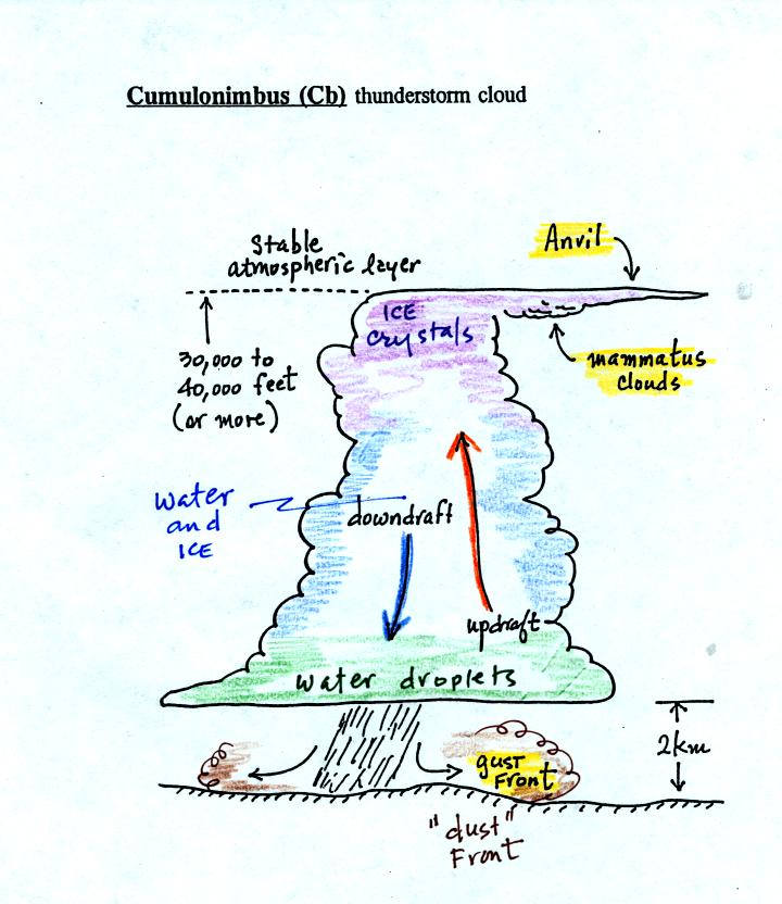
There are lots of distinctive features on cumulonimbus
clouds including the flat anvil top and the lumpy mammatus clouds
sometimes found on the underside of the anvil. Cold dense
downdraft winds hit the ground below a thunderstorm and spread out
horizontally underneath the cloud. The leading edge of these
winds produces a gust front. Winds at the ground below a
thunderstorm can exceed 100 MPH, stronger than many tornadoes.
The top of a thunderstorm is cold enough that it will be composed of
just ice crystals. The bottom is composed of water
droplets. In the middle of the cloud both water
droplets and ice crystals exist together at temperatures below freezing
(the water droplets have a hard time freezing). Water and ice can
also be found together in nimbostratus clouds. We will see that
this mixed phase region of the cloud is important for precipitation
formation. It is also where the electricity that produces
lightning is generated.
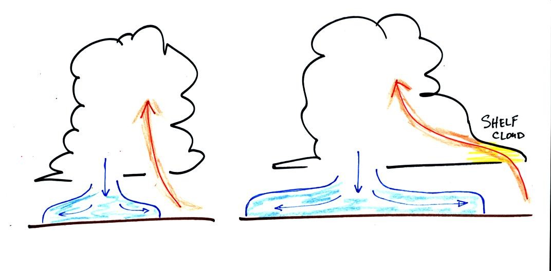
Here's one final feature to look for at the bottom of a
thunderstorm.

Cold air spilling out of the base of a thunderstorm is just
beginning
to move outward from the bottom center of the storm in the picture at
left. In the picture at right the cold air has moved further
outward and has begun to get in the way of the updraft. The
updraft is forced to rise earlier and a little ways away from the
center of the thunderstorm. Note how this rising air has formed
an extra lip of cloud. This is called a shelf cloud. You'll
find a good photograph of a shelf cloud in Fig. 10.7 in the text.


